Wynword Press

A Publishing Company

Wynword Press loves deep literature!   We focus on a few, high-quality titles rather than diffusing our efforts across many titles.  Each title is a book we truly believe in...each of our books has something to offer in addition to a good read.  Whether it's from a best-selling author or a relative unknown, you'll find something here to inspire you, grow you and entertain you.

Beautiful Wyoming

So Wyoming is basically a large, cold desert. I think most of it is technically ‘semi-arid’ rather than ‘desert’, but it LOOKS like a desert. Which is why I like it. There are some riparian areas such as this place I camped along the Green River. This is the view from my campsite on one of the rare occasions when there was nobody fishing there. This must be a fabulous fishing area because there are about a zillion people here fishing every day. At night, they run generators so the fish don’t get lonely (or complacent). Even so. You have to love a back yard like this.

City of Rocks

After a wonderful stay at Craters of the Moon, I detoured south to City of Rocks. ‘Detouring’ is the only way to get to City of Rocks. It is not just out of the way from Craters of the Moon, it is out of every way from everywhere. Still, there were so many hordes of people there that I had to spend two nights in an already-reserved campsite because every one of the 65 campsites in the park had a ‘reserved’ sticker on it. I know. I looked at all of them. I found one that was ‘reserved’ for 9/16 and stayed in it on 9/13-9/14. City of Rocks is a rock-climber’s paradise. Since I can barely walk across a level parking lot without falling over, I don’t do a lot of rock-climbing. My version of rock-climbing is climbing back onto my feet after doing a face-plant into a pile of rocks because I tried to walk over them and lost my balance. However, the massive piles of granite that rock-climbers enjoy scaling are very scenic, as you can see below.

Here’s me camping at CoR. This is my new swing-away trike rack, which is pretty slick, thank you North Idaho Welding and Supply.

There were some rock-climbers on this ‘boulder’ later in the day. It is so big the climbers were almost invisible.

This gives you an idea of the scale of these rocks. That little building is a vault toilet near some campsites among the rocks.

The rocks are everywhere. It’s almost like…an actual CITY made entirely of ROCKS. Go figure.

Craters of the Moon

After a brief stopover in Boise, (not brief enough…no stopover in Boise can be brief enough even if it is 15 minutes at a gas station) I proceeded east to Craters of the Moon National Monument. Craters of the Moon is covered with blasted trees and bizarre lava formations, two of my favorite things in the whole world. The campground was horribly crowded, but that’s because lots of other people also enjoy blasted trees and weird lava formations. There are some lava tube caves at CotM that I hiked into a few (or a number of) years ago, but apparently they now require a special permit that I didn’t bother to obtain. I was perfectly content to ride around the scenic loop on my trike and admire the blasted trees and weird lava formations.

Trail to North Crater

One of many blasted trees

Giant heap o’ lava

More giant heaps o’ lava

Hart Mountain Antelope Refuge

After a wretched 2 or 3 months in Bonners Ferry getting my trike repaired (after running over it when my trike rack failed) and a new trike rack built (hopefully too high off the ground to bottom out and fail again), we are off and rolling at last. First stop, Hart Mountain Antelope Refuge. The goal was to arrive before the hunters did shortly after Labor Day, and that goal was achieved. That is the benefit of setting modest goals…one is able to congratulate oneself on scoring a constant series of microscopic victories.

Hart Mountain is in southern Oregon east of the Cascades, so it is high desert…I’ve yet to meet a desert I didn’t like. It also has a small collection of hot springs into which I enthusiastically plunged, ignoring the algae and bits of muck that settled on the bottom of the pools and came up in waves when disturbed by human feet. There was a lovely pool that appeared to be missing both the algae and the muck, but it was barely warm, so I gave that a pass. In fact, I chose the worst-looking pool (1/3 to 1/2 covered with algae flotillas) under the assumption that it would be used by fewer other people, and, indeed, I had it all to myself. That was a good thing, since it’s really only big enough for one person.

I also inaugurated the rebuilt trike, with good results. Drive train working properly for the first time in, oh, 18 months or so. Unfortunately, the propulsion system (legs) seems to have suffered from months and months of inactivity, so the rides were short.

Here is the beautiful, clear, deep pool at the hot springs. Unfortunately, it’s also not very hot.

Here is the nicest of the two natural pools. No algae flotillas here. It is also the hottest pool, and the one preferred by most people other than myself.

This is what the refuge in general looks like. Here is my trike at Lookout Point

Butte on Blue Sky Road

Big Sur

After viewing the otters, we drove past San Simeon (one of the world’s most tasteless mansions — it’s well worth seeing just so you know that money can’t necessarily fix ugly) and up to the southernmost end of Big Sur. I haven’t been to Big Sur in 45 years or so. It is really beyond compare. It’s a shame I messed up my camera settings, but there are some landscapes that are so beautiful they cannot be ruined by poor photography, and Big Sur is one of them.

looking south toward Harmony Point/San Luis Obispo

Otters -- or should I say "otter silhouettes"?

From KofA, I made a mad dash over to the California coast to visit my sister. The California coast is gorgeous. I’m sure this fact will surprise no one. North of Morro Bay, there is another bay whose name I forget, (possibly Escondido?) and near one of the jetties jutting out into the bay there is a colony of otters. Naturally I had to go see the otters. It was great seeing the otters. The weather was perfect, and the area is lovely. There were dozens of otters lolling about amidst the rocks and seaweed, turning summersaults and doing barrel rolls. Unfortunately, due to a number of factors, all 200+ of the photos I took were total crap.

1) My camera was still set on ISO 6400, so all the pictures are horribly grainy

2) My best zoom lens is only 200 mm. This magnification was inadequate to shoot the otters.

3) And, probably most importantly, the light was behind the otters, so they weren’t lit up. I could only see otter silhouettes, flapping legs and tails, heads bobbing around, etc.

Of these (the flapping, rolling, heaving silhouettes) I saw many. And just to prove that there were, in fact, otters and I did, in fact. see them, I selected these from my 200+ photos…they all looked pretty much like this.

The otters like to float with their heads and feet sticking out of the water, and that’s basically what you see of them: heads and feet bobbing around in the water. There’s a lot of splashing and flailing legs as they roll around.

This one was doing summersaults.

KofA - Crystal Hill

When we had overstayed our welcome near Yuma, we went back to KofA, this time at Crystal Hill, where there’s a camping area along a wash with actual trees that cast actual shade. Shade is helpful when the temperature is pushing 100 degrees.

On the way to KofA, I wrecked my trike, so it is now totally unrideable. That makes sightseeing a bit tough for someone who can barely totter 2 or 3 miles even when decked out in major gear such as leg braces, knee-braces, heavy boots and hiking poles. However, I was determined to walk up to a saddle in the mountains to the south of my campsite, so I undertook a four-hour hike, barely reaching my goal. It would have taken a normal person a couple of hours. From the saddle, one could see….more desert. It’s a great spot if you like the desert.

If you zoom in, you can see the Ocotillo are in bloom…there’s one in the center of the picture.

It must have been right after I took the above photo that, in manhandling my camera around as usual, I managed to lock the ISO setting on 6400 (again). So all my photos became horribly grainy. The picture below (looking back across the valley toward where I am camped) is so grainy that it almost looks like an Impressionist painting.

That dark hill in front of the lighter hills in the distance is Crystal Hill. I am camped at the foot of that hill. I have no clue how many miles away it is, but I estimate somewhere around 3. Yes, it takes me 2 hours to walk 3 miles. That is how speedy I am.

Bees in the desert

It turns out that there are bees in the desert (honey bees, I mean). It also turns out that they are constantly on the lookout for water. So I stood on my little scrap of indoor-outdoor carpet to take a shower one day, and a few minute later, the carpet was ‘claimed’ by about a zillion bees. The bees were so persistent in their pursuit of water that I started doing my moisture-producing chores (such as washing dishes) several yards from my door because the bees kept flying into my rig. I don’t like bees in my rig. I like honey bees (as opposed to wasps and hornets), but not in the house. They land in various places where I don’t notice them, and then I put my hand or foot on one and it stings me. I did get stung once, but honey bee stings aren’t terribly painful so it was no big deal. Harvester ant stings are much worse. They are similar to wasp stings and hurt for hours. I discovered that I could deal with them by removing cold apples from my refrigerator and applying them to the sting for 3 or 4 hours until they stopped hurting.

Cibola Lake

Several miles south of our campsite in the Cibola wildlife refuge (according to the map) is Cibola Lake proper. It’s an odd place. I rode my trike down a road which, according to the map, runs right along the lake for miles (3? 5 maybe?) and saw…pretty much nothing. There was water all right: the Colorado River (which at that spot looks about as wild and river-like as the All American Canal). But where was the lake?

At the end of the road, I found an 'overlook’ of the lake, and the first photo below is the view from that overlook. Sluggish channels through the reeds. I guess that’s the lake. On the way out, I stopped at two parking areas labelled ‘Cibola Lake’ and realized that they were access points to the sluggish channels through the reeds for intrepid boaters desiring to fish the “lake”. They were both closed.

Now, if we left the overlook and looked south, we saw something that actually resembles a lake, but I could not find any road in, even a bad one. So boaters are confined to the marshy area.

At the end of the road, there was this cable car across the Colorado. I spent probably 20 minutes trying to figure out how it might work with only limited success. Most notably, I wondered what fail-safe mechanism there might be in case someone (just as an example) put their trike on the cable car and tried to cross the river on it, reached the middle of the river and discovered the teeny motor I heard running but could not find was incapable of pulling the car/rider/trike to the other side. As you can see, there’s a substantial dip in the middle of the cable, so getting back to shore is an uphill climb. Like, wasn’t there a rope one could pull on to manually haul oneself to one side or the other in case of emergency? Apparently not. I was unable to find any such thing. So I didn’t try riding the car (tempting as it was).

Here is the view from the Cibola Lake overlook. Hm. This area of semi-watery material is where the boating access points to Cibola Lake are.

So here’s something that looks lake-like. But it is nowhere near the ‘Cibloa Lake Overlook’…in fact, it is in the opposite direction. And the ‘Cibola Lake’ access parking lots are nowhere near this body of water either. It’s all very confusing.

Here is the freeway bridge across the Colorado near Cibola Lake.

Cibola Wildlife Refuge

When we had stayed out the permitted two weeks in KoFA, we decided to explore Cibola Road, which traverses 45 miles between US 95 and Cibola Lake on the Colorado River. Most of the road is good, but there are several areas I wouldn’t drive an RV over, and they are at the far end, so no turning around unless you want to drive 35 or 40 miles back out. According to the map, this 45 mile dirt road is the only way into the lake…not true. It took us close to 2 hours to drive the road, and we arrived only to discover pavement, giant snowbird RVs, and the wildlife refuge headquarters. So basically we spent 2 hours driving a crap road when we could have come cruising in on the pavement.

Anyway, I’ve camped Cibola before and didn’t like it. This time was way different. Before, I was stuck in an abysmal spot called “Hippie Hole”. It was the first year of CoVID, March or April, I forget which because I have blocked it out. I suppose it didn’t help that it was 100 degrees and the place was jammed. It was only a few feet from the river, but you couldn’t access the river because the bank is impassible in most spots, and in the couple of spots where it was not impassible, people had set up elaborate camps and claimed the entire riverfront. I think I stayed for two nights and fled in disgust. 

This year we camped in the desert a bit south of headquarters, on the Arizona side (Hippie Hole is, I believe, on the California side). We were only 3 miles from headquarters, so I rode my trike around the “auto tour loop”. The weather was fabulous, the skyscapes incredible and there was a great little riparian area with a nature trail. I saw hordes of Snow Geese, many ducks, and some Sandhill Cranes that were grazing in a corn field.  

Snow geese on the Auto Tour Loop

Sandhill cranes

Cibola sky

KofA Wildlife Refuge

KoFA wildlife refuge is a spot I return to every year. This year though, I bypassed the Crystal Hills area where I usually go and continued south to King Valley. The road into King Valley is quite good, better than Crystal Hills, but it’s 15 miles or so south, so further from Quartzsite (which is a good thing) and there’s no cell service, not even the crappy service you get out of Quartzsite at Crystal Hills. The only downside to King Valley is that it’s all wilderness so you can’t camp more than 100 feet from the road. I found this out the hard way by getting busted for being 400 feet off the road. The person who busted me was totally unimpressed by my explanation of how I came to camp in a non-sanctioned area and promptly erected a new “do not drive here” sign to keep me in line on future trips.

I rode about 8 miles down the road from our campsite but didn’t make it to the mine site (KofA stands for “King of Arizona”, an old mine). Maybe another year. Instead, I contented myself with gazing at the whimsical shapes of the mountains visible from our campsite.

Moonrise in King Valley

King Valley mountains near sundown

Mojave Preserve

I camped in the Mojave Preserve last year about 100 feet from the road. People came streaming into my campsite all week, and one person actually plopped his rear a few feet from my door and stayed there all night and half the next day in an Involuntary Campsite Sharing Incident. I was not eager to repeat that experience, plus now I have a back-country-capable vehicle, so we drove into the mountains to camp among the Joshua trees. The road in (Ivanpah) wasn’t bad. Driving out over New York Mountain Road was quite the experience, though. Definitely wouldn’t recommend that for a regular car. A lot of it was quite passable, but there were some gnarly spots that would have been quite hair-raising (were quite hair-raising even in a truck), and once I actually had to shift into 4WD to get un-stuck out of deep gravel. Not to mention bashing my trike rack against the ground several times due to severe unevenness in the road.

The Mojave Preserve is great…I plan to return there on a regular basis. It’s not all that photogenic, but here’s a snapshot of the terrain around our campsite just to give you the flavor of it.

Afton Canyon (continued)

As it happens, we did end up driving across the river into Afton Canyon. There actually were two water crossings, and the second was deeper than the one I photographed. Due to a camera malfunction, there’s no photo of me up to my bumper (and a fraction of an inch below my doorframe) in Mojave River… darn. However, I did make it across (obviously…since I am posting this) and saw some grand, eroded desert-scapes. 

Interesting striae in rocks

Layers of eroded mountains

Eroded cliffs looming over our parking spot in Afton Canyon

Afton Canyon

Finally! Alone at last! Here is Afton Canyon Natural Area between Barstow and Baker on 1-15. I am not camped in this lovely spot. It is possible to camp here, but it costs actual money, a total anathema to the Vagabond Tourist, even though the fees are quite reasonable ($6.00 per night, or, if you are old and have a pass, a mere $3.00 per night). Instead of shelling out the 3 bucks, I selected a spot on the desolate plateau directly outside Afton Canyon where, at night, I can watch the ribbon of light as thousands of cars stream down the freeway a couple of miles away. And in the day, I can trike into the canyon, which as you can see is lovely.

We are overlooking the campground…there is an RV in the distance. The road in is suitable for RVs, although there is one steep hill with some loose material that may cause momentary loss of traction. I didn’t see any huge rigs in here, but there were some moderately sized rigs. I would drive my 30 foot class C in (if I were driving it anywhere ever again).

Just up the road from the campground

Maybe 500 feet past the campground, there’s a water crossing. It is passable (a phalanx of about 5 vehicles drove through it 10 minutes before I reached it), but it wasn’t that great for triking. I rode about 1/3 of the way across and the water was deep enough to reach the middle of my wheels and getting deeper…that would be about 12 inches. I imagine it probably wasn’t more than 18 inches deep or so (the bottom was invisible due to mud, possibly stirred up by the 5 vehicles ahead of me, so who knows), but I didn’t feel like getting wet so I gave it up. I’d probably do it in the truck. In fact, I might do it in the truck another day.

Here’s a better view of the crossing. This is the Mojave river, which runs through the canyon.

Spangler Hills

After resupplying in Ridgecrest, we popped over to Spangler Hills recreation area for a week. I liked it…the first night. Then about 500 RVs rolled in with boom boxes and OHVs and motorcycles and set up miniature RV cities with loud party music and American flags with motorcycles appliquéd in the middle. Thankfully (and I bless them for it), they did abide by quiet hours and faithfully turned the music off at exactly 10 pm. Unfortunately for me, I am still on Mountain time and it seemed like 11 pm to me. Whereupon they got on their motorcycles and roared through the desert for a couple more hours. What is it about nighttime and the desert that is irresistible to drivers of motorized vehicles? Tungsten Hills: cars driving through your campsite at midnight. Saline Valley: jeeps driving over Steele Pass (and into your campsite) at 3:00 am. Spangler Hills: motorcycles roaring through the desert at midnight. I don’t get it. What if you fall into a mine shaft or get buried in a wash or drive into a river in the dark? Or just lose the road? Some of them are pretty hard to follow even in broad daylight.

I shot around all the RVs to capture this moonrise. I didn’t figure anyone would be interested in seeing 25 giant rigs huddled together as if awaiting the apocalypse..

Alabama Hills...moonrise over the rocks

We left Saline via the South Pass (never again). It’s only a few miles longer than the North Pass road, but the road is slower and rougher, takes almost twice as long and punishes your tires, so another time I’d pass on it (pun intended). It dumped us off in Lone Pine just a few blocks from the Alabama Hills, so we spent the night huddled beneath the rocks.

Moonrise

This campsite was not exactly the best for solar cookery, so we bought pizza in Lone Pine

Saline Valley Part 2

So I went back to Saline Valley and spent almost 3 happy weeks there…happy except for the crowding. One night, two other vehicles invaded my campsite (unheard of! bad camping etiquette!!). Still, even with the hordes of people, it is an awesome place. Another year though, I will come at a less popular time, like maybe before it cools off.

2.25 miles up the “road” from the upper springs (actually a trail of boulders interspersed with sand and large gravel), there is a natural warm pool. Although my trike was malfunctioning horribly (slipping out of gear), I wanted to see it badly enough to trike up there anyway. Once. There is nothing worse than trying to bike when your bike won’t stay in any gear, particularly when you are on sand, gravel and boulders. It’s a testimony to my —er— persistence (or shall we call a spade a spade and say stubbornness) that I made it there and back at all. After readjusting my derailleur for the 500th time to no avail, I discovered that my cassette was bent. I tried to straighten it enough to ride with a pair of pliers, but it only got worse. Another year (and I will be back) I will ride up a bunch of times as I prefer the natural pool to the concrete ones.

Someone at the hot springs told me this pool was all full of black scum. Is it just me? I don’t see any scum of any color. In fact, I plunged in with all my clothes on, had a great time wallowing for a while, and came out cleaner than I went in.

Here’s the setting of the pool. I was bummed to learn that all these palms were added by “improvers” (meaning people). I had thought they just sprang out of nowhere because of the water, but no.

Dreadful weather coming over the Sierra

I was forced to leave Saline Valley, totally against my will (and I threw an almighty temper tantrum over it which only ended this morning), due to business, which I was unable to conduct because there’s not a hint of a Verizon cell signal within 50 miles of Saline Valley. AT&T people can get service from the lower springs, but I am not one of these. So I had to drive out. And I had to drive out a day before my deadline because there was a horrendous storm on the way and I thought I might get snowed in due to bad conditions at the pass. This is the sort of unpleasantness nomads have to put up with.

Anyway, I didn’t want to return to Buttermilk Road because of the dead-end-creek-Tungsten-hills-people-all-over-my-campsite thing, so I looked for another site and found one off of Pleasant Valley Dam Road on the bluff overlooking Bishop Creek and Owens Canal. Very lovely view. There, I watched the predicted storm come rolling over the Sierra. There, I sat in the nano-house all day and night while the rain pounded away on my roof and created huge puddles on my tailgate so I couldn’t go outside without releasing a flood into the house. There I sat, hoping my roof would stay on and I wouldn’t lose my solar panels, while my rig made such noises as I have never heard before as the wind howled across the desert and the storm, after way more hours than I had hoped, finally blew itself off to the east. It would have been just as scary in Saline Valley…there was a wind advisory there, too…but it would have been drier and it would have been 55 or 60 degrees instead of 30. After the storm passed and the sun came out and it warmed up a hair, the campsite looked nice again, so I stayed another day.

For those who are also out wandering aimlessly around the southwest who also want to possibly find campsites, I can only recommend this one to people in SUVs and pickups. It isn’t the kind of track you want to drive an RV on. However, there is what promises to be a nice BLM campground very close to this location, I believe it’s called Pitt Creek or Pitt Valley or Pitt Bluff or Pitt something. It costs money. That’s why I’m not there. But it doesn’t cost a lot of money, maybe $5 a night (or $2.50 if you are the Vagabond Tourist and you have a golden age pass). So maybe if you’re driving an RV you could check that out.

Here is the storm coming over the Sierra toward my campsite. The temperature dropped 20 degrees and I hunkered down under torrential rain (24 hours) and howling winds (36 hours) that made my rig crack, groan buckle and rock…it was NOT FUN.

Here’s the aftermath of the storm, looking west to the Sierra.

And here’s what I now have to get through, basically, to get back to Saline Valley. Now we’re looking east, not exactly toward the pass, but sort of. Maybe we’ll try that tomorrow.

Saline Valley Hot Springs

As I mentioned, our goal was the Saline Valley hot springs, or warm springs as the National Park Service refers to them. They are just fabulous. and teeming with people, which is sort of a bummer. Most of these people are not wearing any clothing, and it tamped down my zeal for photographic documentation. I didn’t feel all that comfortable jamming a camera in peoples’ faces to take pictures of the lovely pools when they were all full of nude people. Or clothed people, for that matter. I wanted to photograph the POOLS, not the people, and I couldn’t seem to make it happen.

At the upper springs, where we were camped, the pools were…well, just pools. Clean, lovely cement pools and all that, but nothing special to look at. The lower springs pools had some pretty workmanship, inlays or mosaics, and would have made a nice picture if not obscured by bodies. I plan to return ASAP and will try to catch them empty. There was also a nice lawn at the lower springs. Weird to have a lawn in the middle of the desert, but it’s more of an oasis than a desert right around the pools. They are surrounded by palm trees (see below).

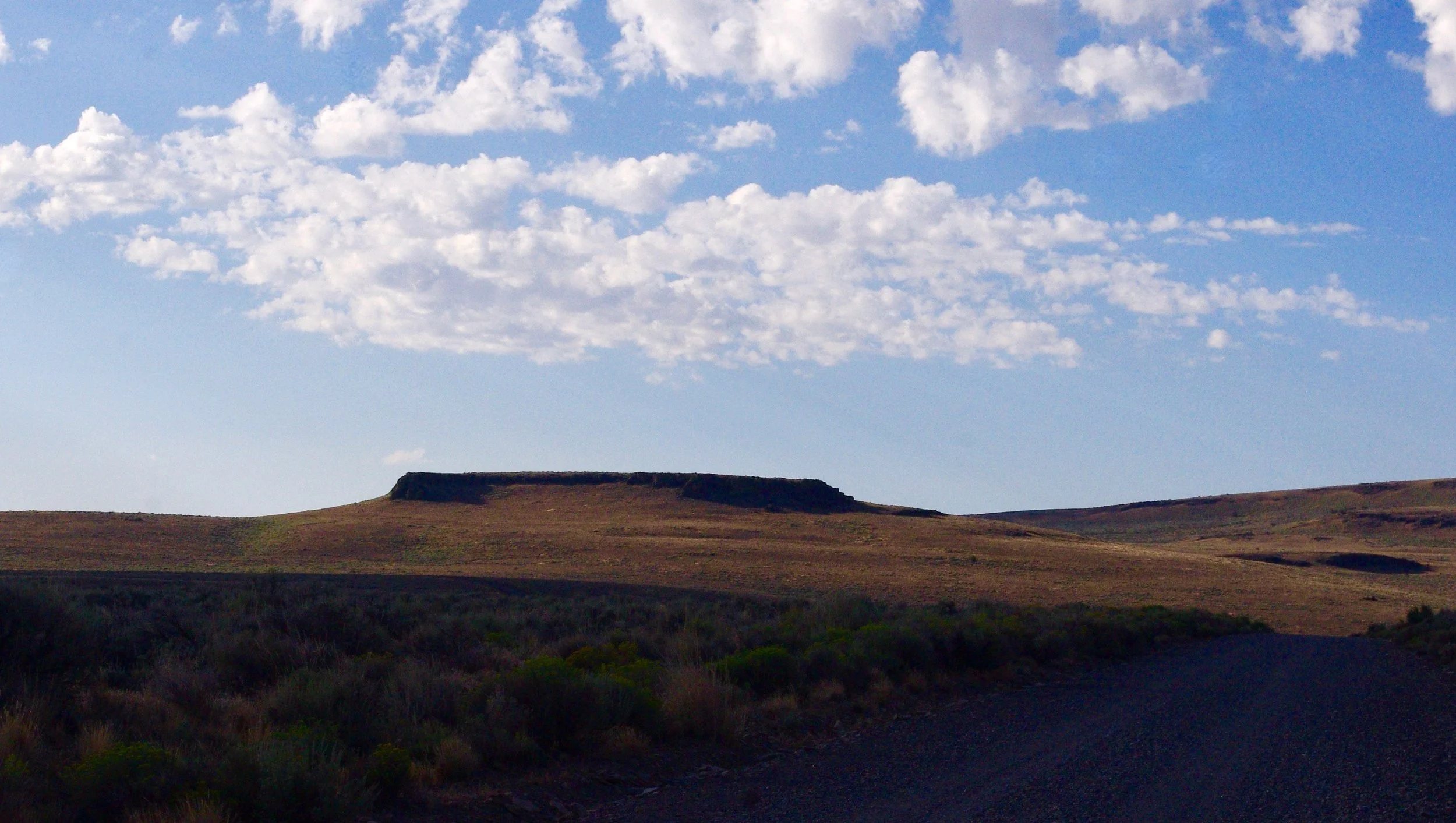
The rest of the landscape is typical desert, as you can see. Fortunately, I am extremely fond of the desert. I chose not to use the pools, which are officially closed due to Covid, but everyone else was using them. I used the inexhaustible supply of hot water to do laundry and take showers instead. I could do that without cozying up to a bunch of potentially infectious strangers.

Perhaps I should mention, since you may want to see the hot springs yourself (which I highly recommend) that the roads in are bad, particularly the last 5 miles or so after you turn off Saline Valley road and head across the playa to the springs themselves. People drive all sorts of vehicles in there, so it really depends on 1) how determined you are, and 2) how willing you are to tear your vehicle up. The majority of people drive pickups and SUV’s. The most prevalent rig was a truck or SUV with a rooftop tent. Pickups with popup campers (Hawks or Palominos) were the second most prevalent. There was a van or two. A passenger car would make it, but it wouldn’t be fun. An RV would probably make it (a smaller one), but it would take a LOT of abuse. The photo below shows a couple of rigs. Both of these were pickups with popup shells, although one looks like a trailer (it is not). The road issue is roughness as opposed to clearance. I did bottom out my trike rack a couple of times, but just touches, nothing serious. In my old RV, I would have been hyperventilating and growing ulcers, and I would have scraped the bottom of the door frame getting to the upper springs. I cannot recommend driving a travel trailer in here, although I’m sure someone has done it — someone has done almost everything. I understand these “someones” have also, on occasion, broken axles getting in, so….

This is one of the upper springs pools from my campsite. As you see, it is a clump of palm trees surrounded by desert.

Here is moonset (at sunrise) looking northwest from the upper springs.

North pass into Saline Valley

Our goal was the Saline Valley hot springs, and when cold temperatures and the threat of a major windstorm drove us out of Harkless Flat, we went a short way into Death Valley National Park, near the north pass into Saline Valley (name unknown) and walked up to this old cabin to see if we could get a cell signal.

At the rear of this cabin (or should we call it a shack?) is a deck with a million-dollar view. I believe it looks toward Eureka Valley. Inside the cabin is a very weird selection of supplies such as Clorox and a first aid kit. The first aid kit certainly seems prudent, but why bleach?

When the cabin is renovated, as I’m sure it some day will be, I suggest that we provide access to the deck from inside the cabin, or at least a pass-through window. Currently, residents and visitors must exit the cabin via its only door (which you see in this photo), clamber over some rocks beside the chimney, and climb a couple of rickety steps (with no railing…is that to code?) to get onto the deck. Now this is not something we want to have to do when we are carrying, say, a tray of cocktails for our guests, is it? It creates an inconvenience when we’re trying to have a tennis party or some such thing.

Note that some upgrades have already been done: there’s glass in the windows. Myself, I would have made them capable of opening, but maybe they were renovating on a shoestring budget.

This is the view from the deck. Pretty nice, huh?