Ruby Hot Springs 5/1/23
Now we skip all the way to May and Nevada. This place definitely rated a photo! It’s also called Smith Ranch hot springs, and the road in was snowy, muddy and bad this particular time of this particular year. I’ve been to several Nevada hot springs, and a number of them have spider mites. I’ve never been bitten at Ruby hot springs, which is a plus. The main pool, which looks small in this photo, is actually sizable and deep. You have to swim across it as it’s too deep to touch bottom, and it’s nice and warm. There’s a large trough down a gentle decline to the north of the main pool where you can soak as well, and the water is even hotter there.
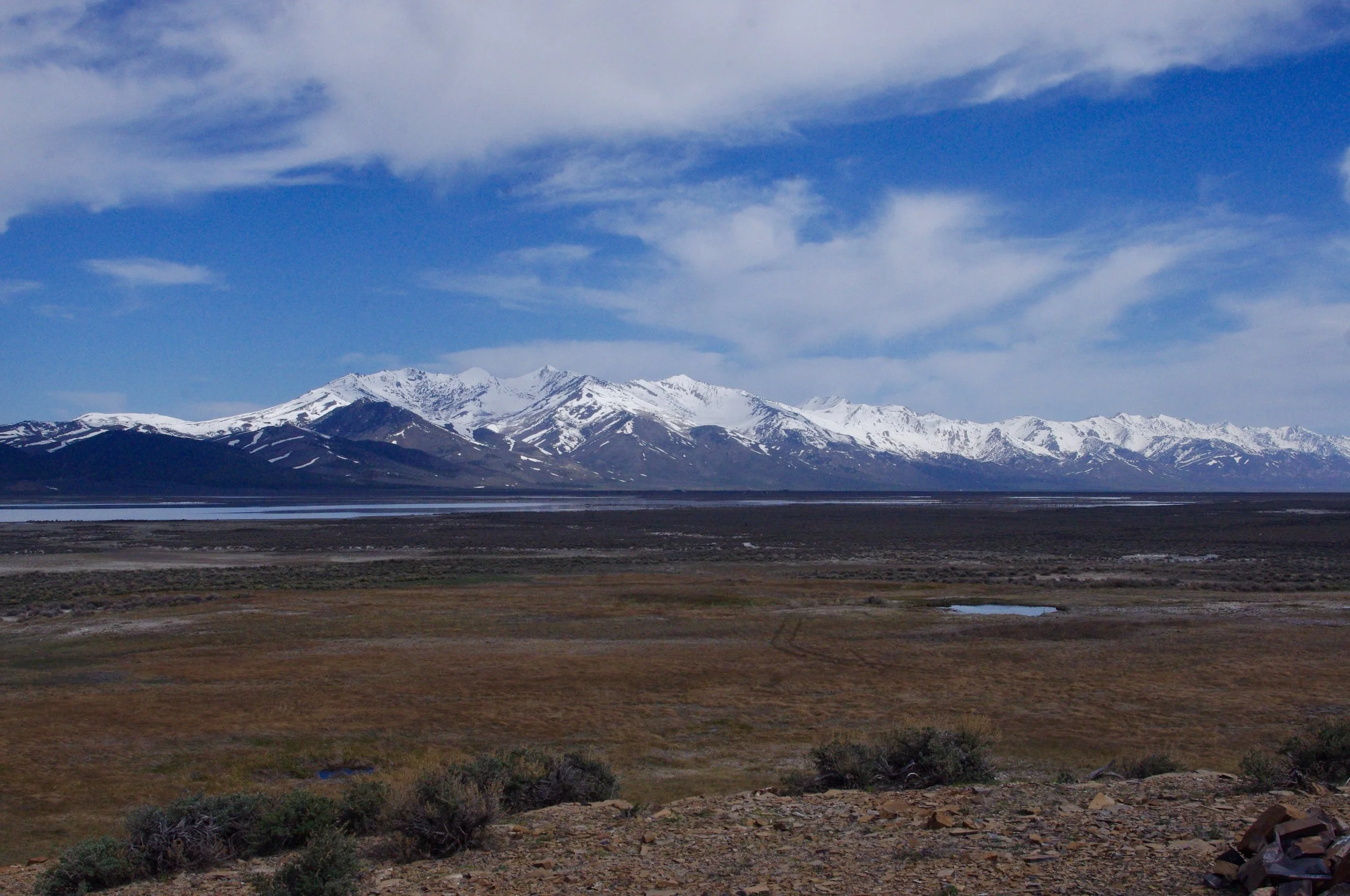
That tiny bit of water in the nearer distance on the right is the main pool. This photo was more about the mountains, which are gorgeous, than the pool. In the background is part of the Ruby National Wildlife Refuge. The campsite I stayed in is on a road that traverses the back of the refuge, but that road was closed at this time of the year and I came in from the north past Smith Ranch instead.
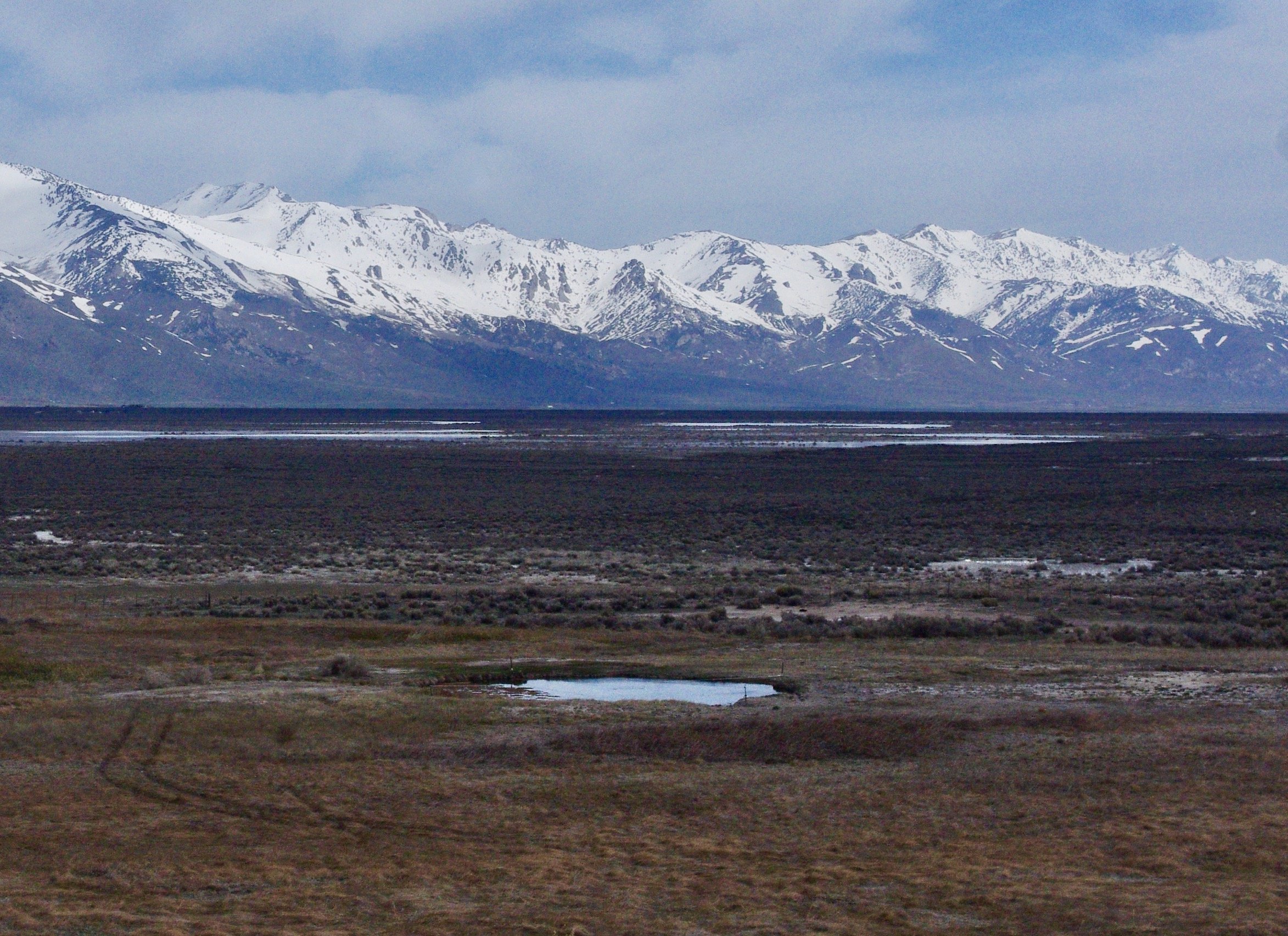
Here’s a better view of the pool. You can see from the tire tracks that people drive right down to the pool, but when I was there it was soft and muddy and I wouldn’t have driven down. Magical view, right?
California Coast 3/23
There’s a big time gap here (and going forward) because by this time I’d stopped taking many photos. Now, looking back from my current vantage point in 2026, when I doubt I’ll ever revisit these places I love so well, I wish I’d taken more. At the time, it seemed redundant and I’d gotten lazy. I thought the photos would just sit in a pile not being viewed until I keeled over dead so why bother? And I was coming back to my favorite spots over and over…I figured I’d rather see them in person than look at photos. Photos are great. But the real thing is so much better.
In any case, for once in a blue moon all my siblings and I gathered at one sibling’s house on the south-central coast of California, and this is not a place I come back to regularly. It’s too far away from the desert. The scenery is breathtaking. There is just no other place like it. The crowds are also breathtaking, but not in a good way. People know nice scenery when they see it, and wads and wads of them come to the California coast to experience it.
Many years ago, I lived on a hill above the California coast south of San Francisco. I wasn’t on the beach, but I could watch the sun set over the ocean every day. That is, I could watch the sun set every day that it was possible to SEE the sun instead of layers of fog. It was a million-dollar view from a $20 tenement. Best view I ever had from any house I’ve ever stayed in, including my sister’s house a mile from the beach where these photos were taken.
Some while ago, I posted a photo of otter silhouettes. On this visit, I managed to capture actual otters! Eating! I LOVE otters!
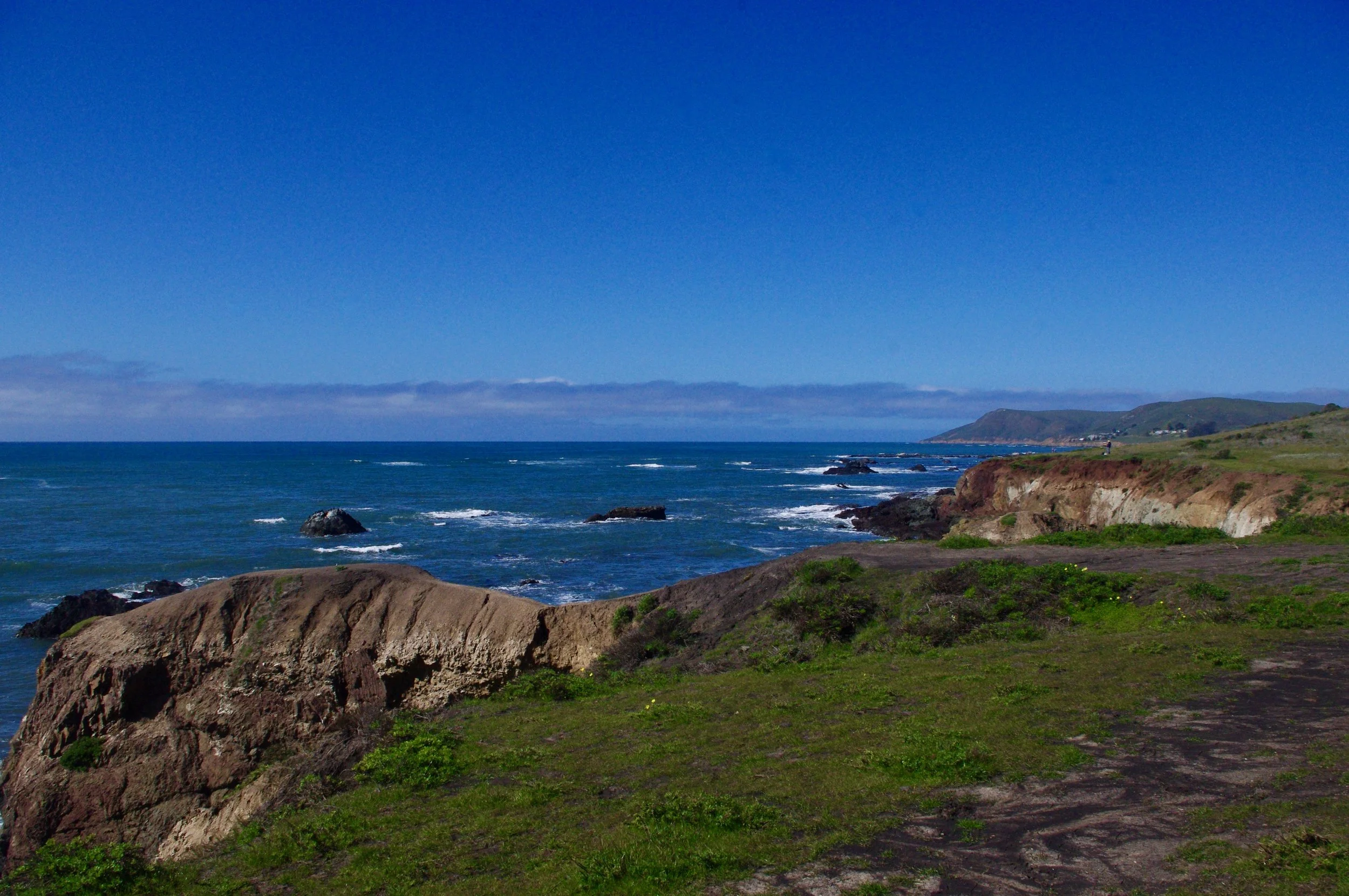
Yeah, it’s gorgeous. My version of eye candy.
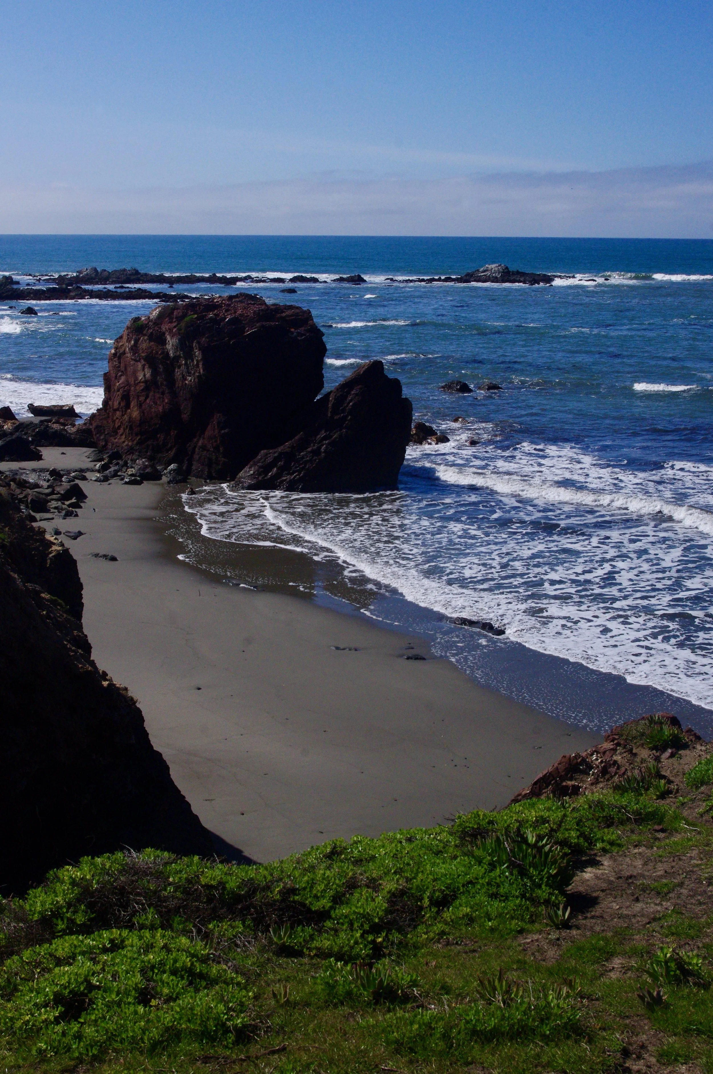
One of multitudinous ginormous rocks.
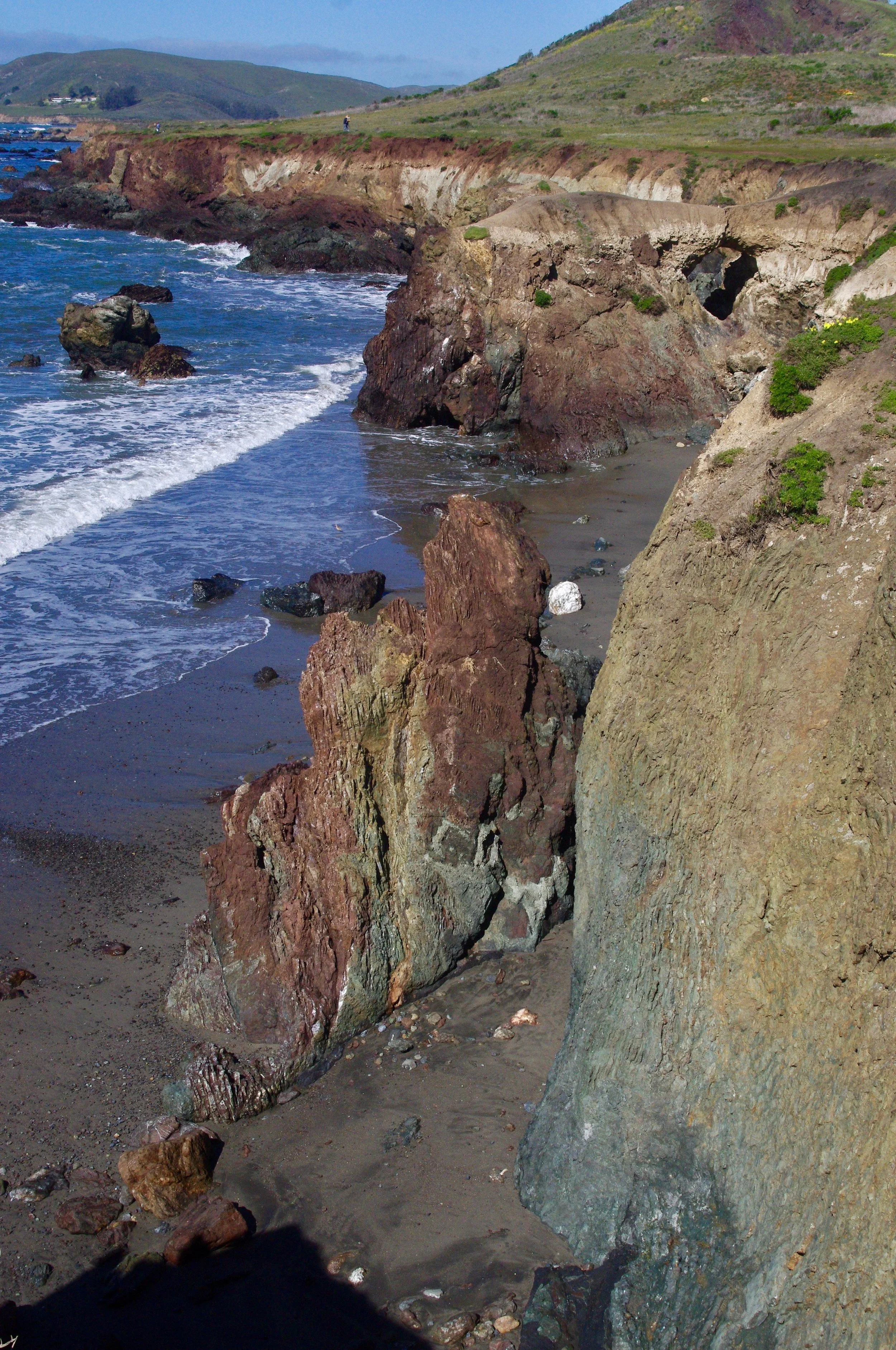
Another ginormous rock. This one has a rock loop in the background. Being of limited capability, I did not climb down to the beach to wade at this point.
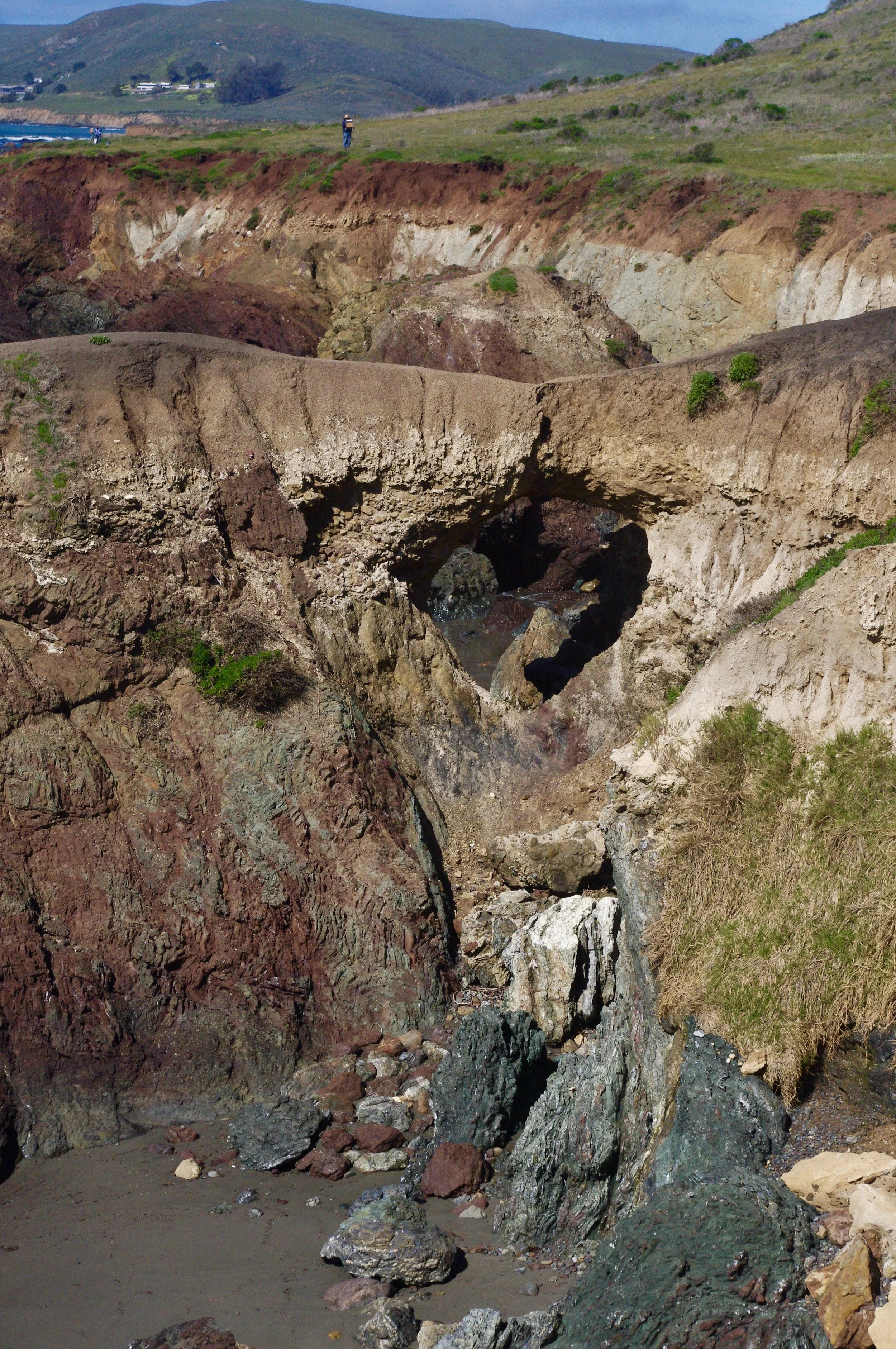
Here is the rock loop closer up. I suppose it has a name, but I don’t know what it is. I’ll bet there are some courageous folk who walk across this loop and out to the point beyond. Obviously, I was not one of them, as I probably would have face-planted one second before I plummeted to a gory death below.
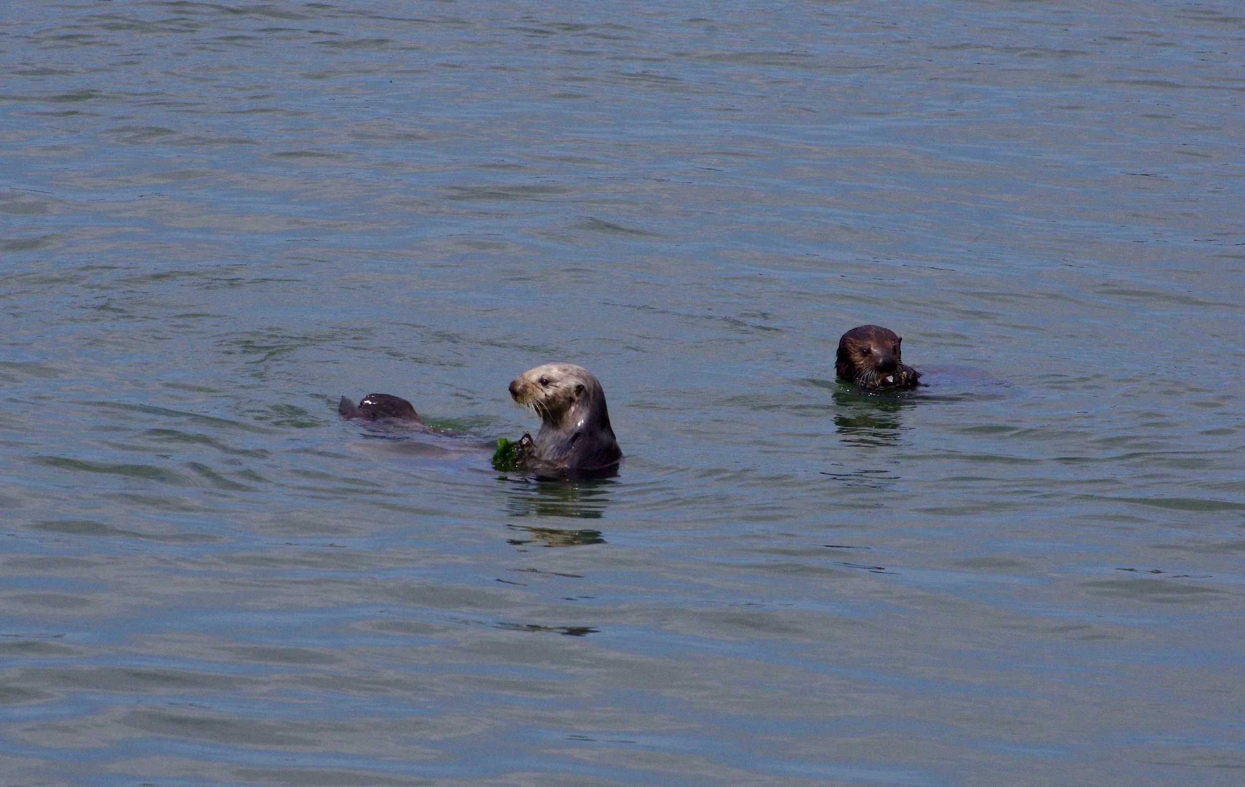
Here they are…actual otters that are actually visible. How great is this?
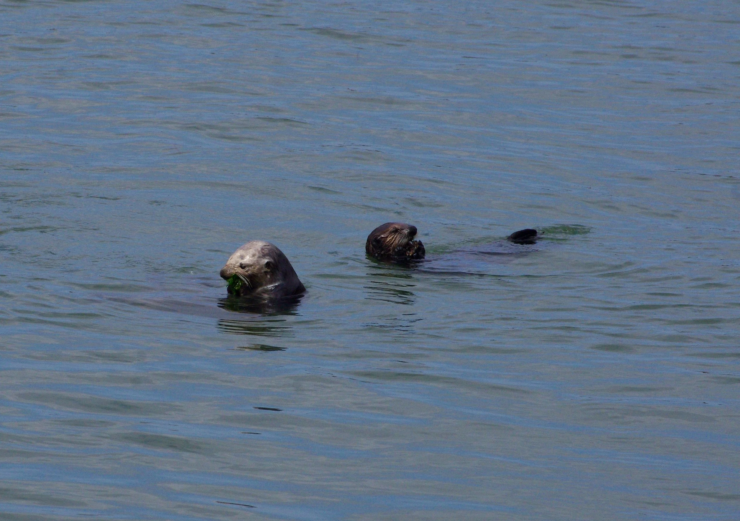
They are totally unconcerned with me and my photography, busily munching away on ????
Alamo Canyon in Organ Pipes National Monument 11/22
This is one of my favorite places on earth: Organ Pipes National Monument. I’ve camped here two or three times over the years, first in a motorhome in the main campground, and this time around I stayed in the smaller and more primitive Alamo Canyon campground, from which you can access the Alamo Canyon hiking trail.
The downside of Organ Pipes is that dispersed camping isn’t allowed. You have to stay in an organized, pay campground. Given the number of people who stay here though, I expect the non-dispersed camping policy keeps the other portions of the monument in better shape for hiking and sight-seeing.
It was during the earlier trip that I had my one-and-only encounter with an illegal immigrant. I was riding my trike down Puerto Blanco Drive toward Dripping Springs. I know Puerto Blanco Drive sounds like a lovely suburban street lined with expensive villas, but it’s actually a dirt road that goes back into the bowels of nowhere. In fact, now that I’m looking at it on Google Maps I’m wondering how on earth I decided I could ride around it in a big loop, circumnavigating the campground and visitor’s center and connecting with the main road on either end. It actually appears to dead-end out in the desert.
I’d been riding for probably over three hours, making much less headway than I thought I would, when I ran into a man with a black one-gallon bottle walking along the “road” (basically a track at that point). He pushed me up a hill, which was very kind of him, and asked me for water, which I foolishly did not have. I’d had some when I started on the ride, but I had thought the whole ride would take me maybe three hours and I’d only brought two water bottles. Most of that was already consumed. My Spanish had deteriorated from passable to almost-non-existent over the years so we had trouble communicating, but I know he wanted to find out where the water was because he was in a bad way. I tried and failed to communicate where he should go and how far it was (very far…there was no water anywhere close by). I then rode on until I reached some point of interest where there was an emergency call station, and pushed the “I'm an idiot; I got myself into trouble here; please come and rescue me” button. A ranger came out and graciously gave me a ride back to the main road. Boy was I glad I hadn’t tried to ride it! I would never have gotten there, or if I had, it would’ve been midnight. I remember it was long and there were areas I could never have ridden across. So maybe the road actually DOES dead-end in the desert and the ranger was driving over a not-exactly-road.
I told the ranger about the border-crosser, and someone else came out to pick him up as well. I saw him after they picked him up and he kissed his hand at me. I’m sorry he probably had a not-very-fun time afterward, but I’m glad he was safe instead of dying of thirst in the desert.
This time around I had no such adventures, just a nice hike into Alamo Canyon. These photos taken near the campground show what the area is like…fields of saguaros and imposing rusty red rocks.
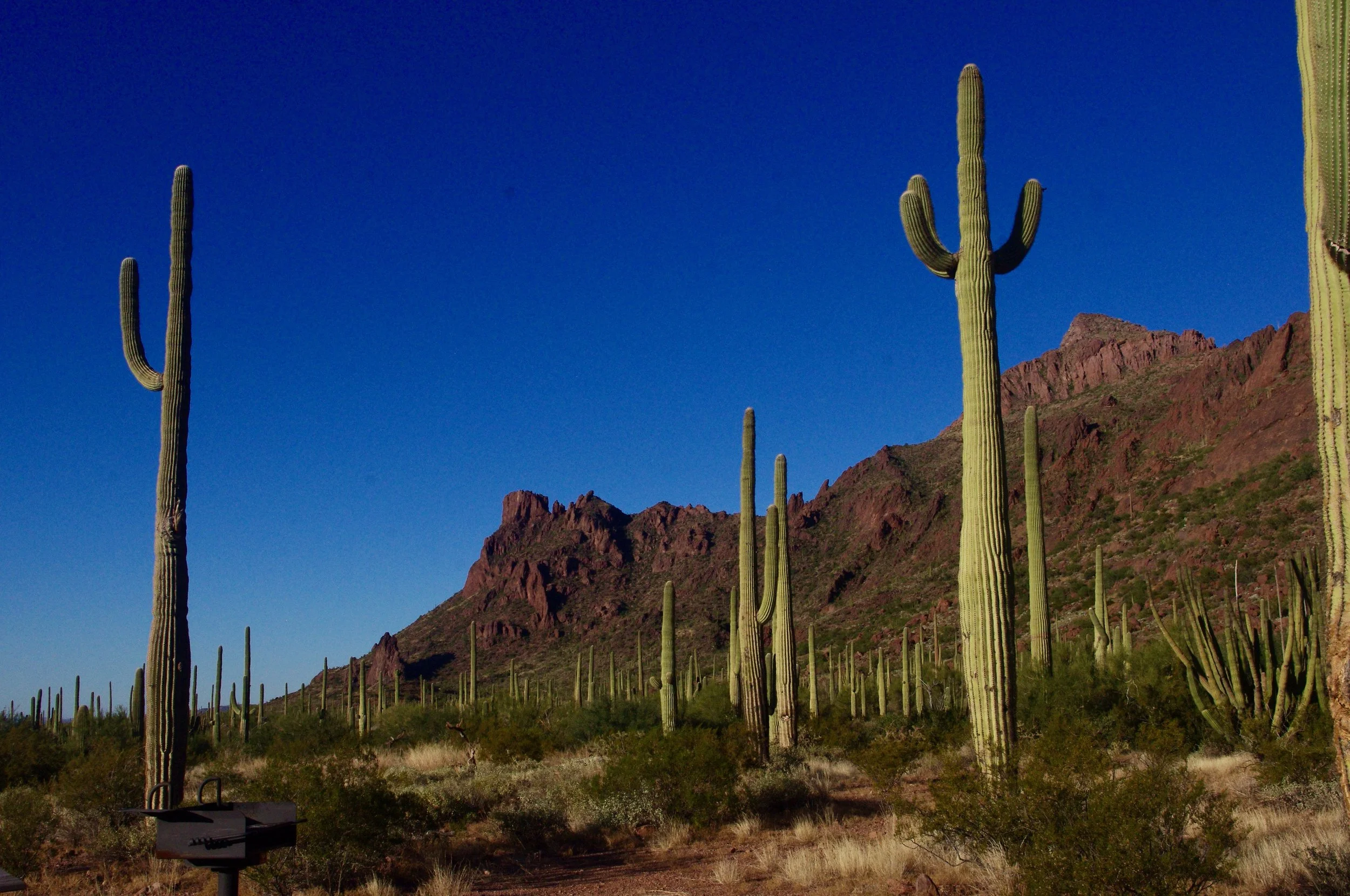
Saguaros. I LOVE saguaros. They are one of the special things about the Sonoran Desert, which is my favorite desert. I love the Mojave, but I love the Sonoran more.
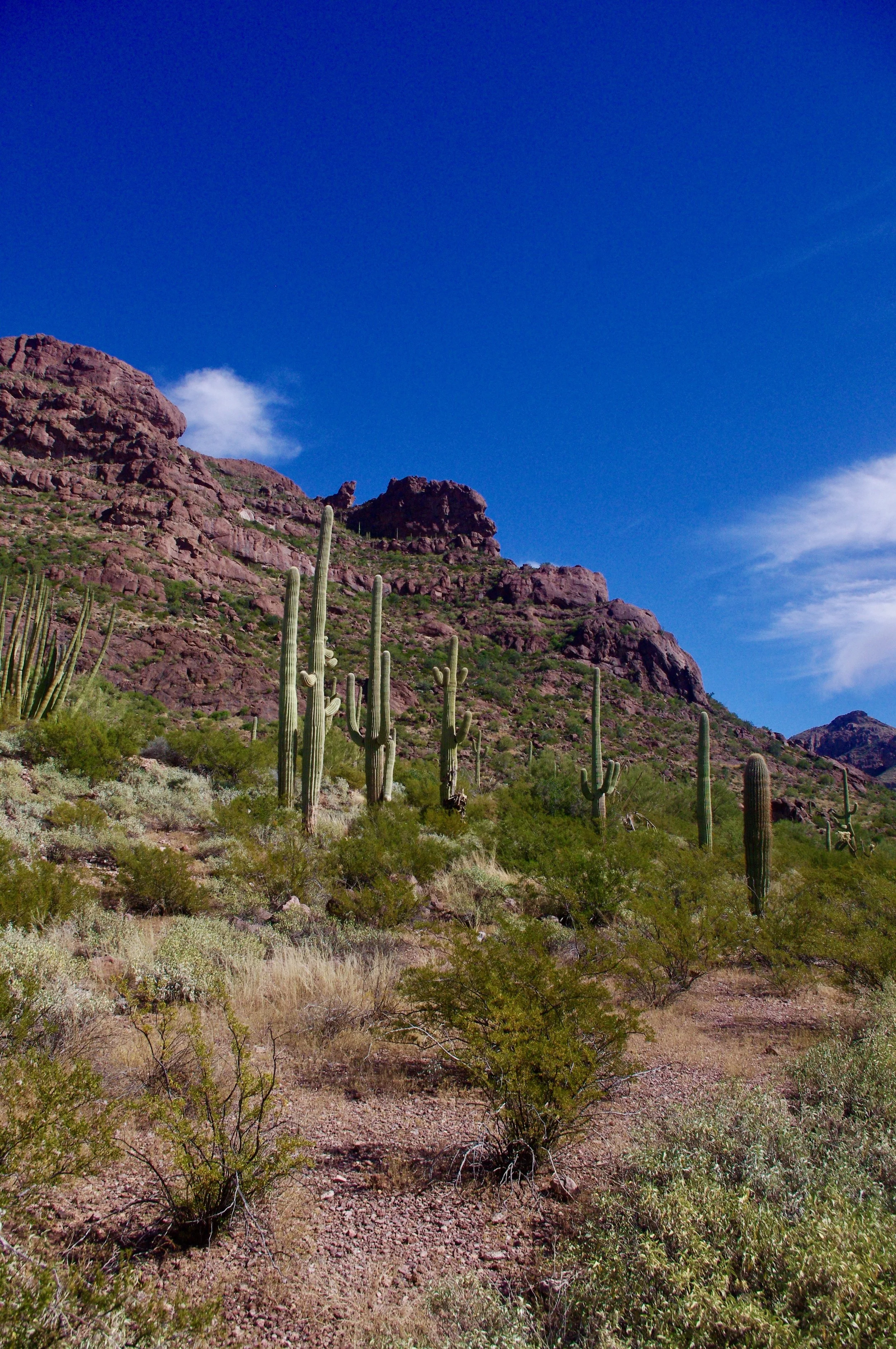
More rocks, more saguaros. You simply can’t get too many IMO.
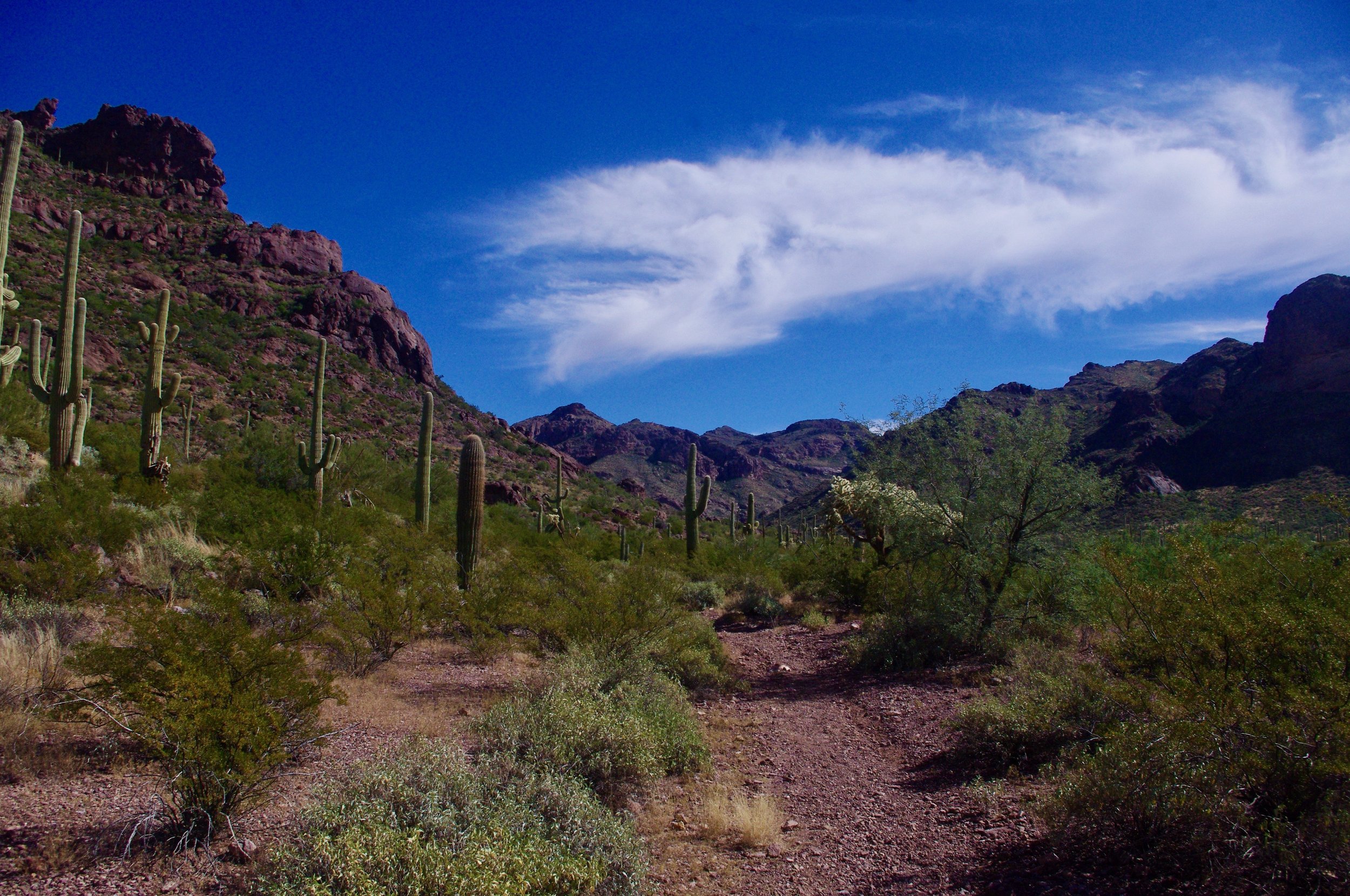
Clouds, rocks, saguaros. Heavenly.
Cabeza Prieta 11/22
Cabeza Prieta National Wildlife Refuge does not appear to be heavily used. I’ve forgotten how I found the camping areas because they are not marked in iOverlander. Maybe they were on freecampsites.net? On the BLM website? In any case, there are three designated camping areas in the refuge and I’ve twice camped at Papago Well. There’s a huge water tank there where you can get drinking water (I’d filter it, though). The first time I camped at Papago Well, I got busted for being too far off the road, which was odd because I camped right next to one of the picnic tables. This time around I ignored the tables and camped within 100 feet of the road so I wouldn’t have to move. There’s another camping area near Christmas Pass where I had planned to camp but for un-remembered reasons changed my mind.
It is hard to get further south than Cabeza Prieta without going into Mexico because it’s right on the border. In fact, it’s SO right-on-the-border that there’s a huge Border Patrol facility on the way to Papago Well, and periodically hordes of Border Patrol vehicles drive around looking for illegal immigrants. The immigrants are there, although I’ve never seen one…at least, I’ve never seen one in Cabeza Prieta. I did encounter one in Organ Pipes National Monument, which is right next door. What I have seen in the refuge are many discarded black one-gallon bottles that are used by border-crossers to carry drinking water.
The road in is long and rough. It’s about 40 miles, and starts out deceptively well going through part of Organ Pipes National Monument and past the Border Patrol facility. Then it deteriorates and stays bad and slow for a good, long time. No big-rigs here. 4WD is probably a good idea, although I didn’t have to use it. There are areas of deep sand and bad ruts.
I’m indulging myself by posting two basically identical sunset photos here. I really prefer the second one, but the first one has a moon! Moon good!
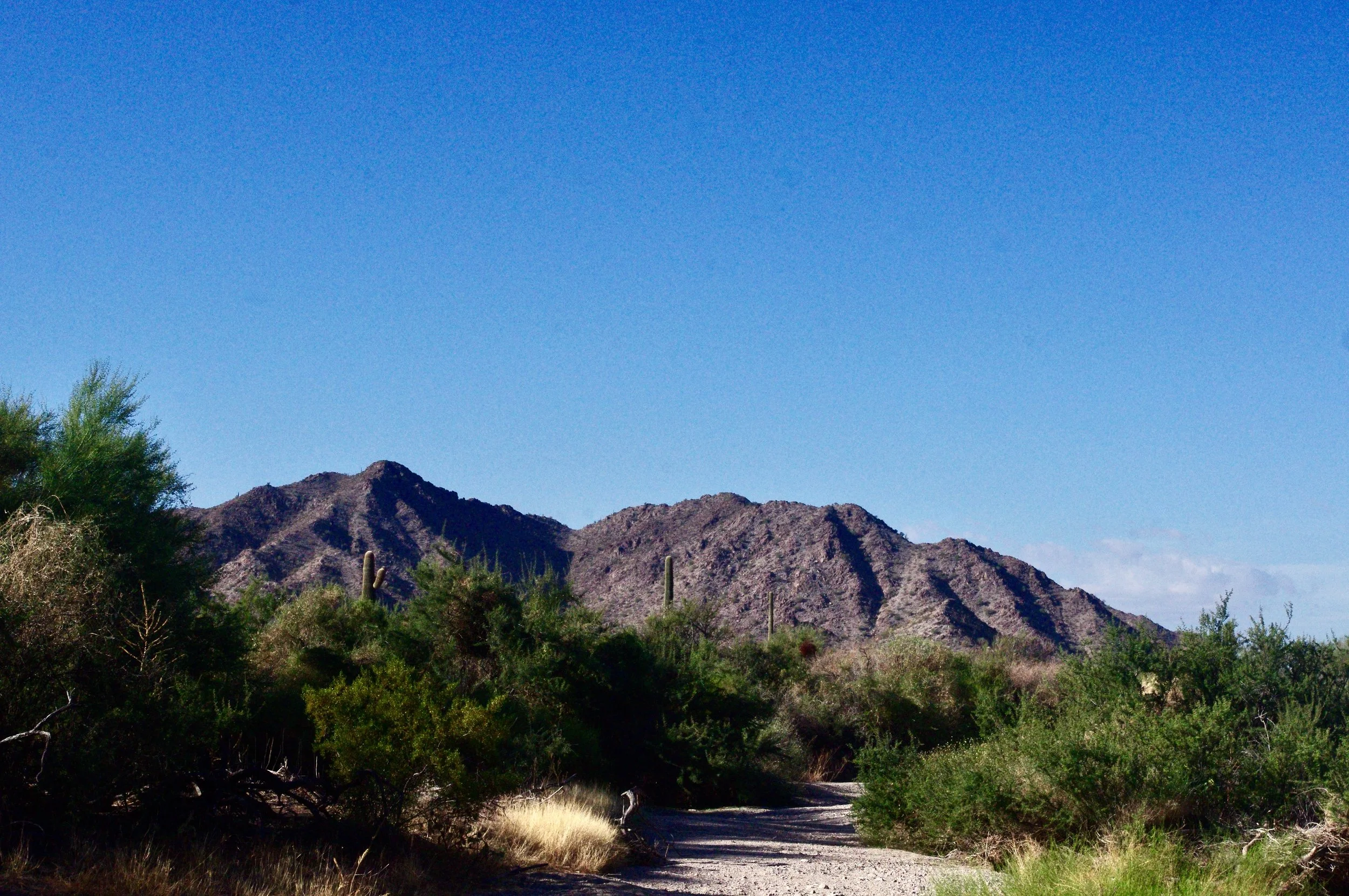
I don’t know what all this graininess is…I probably set the camera on a low-light setting by accident, as I often do. Anyway, I wanted to show you what Cabeza Prieta looks like because it’s hard to get there and most people will never go. This is a wash near the campsite.
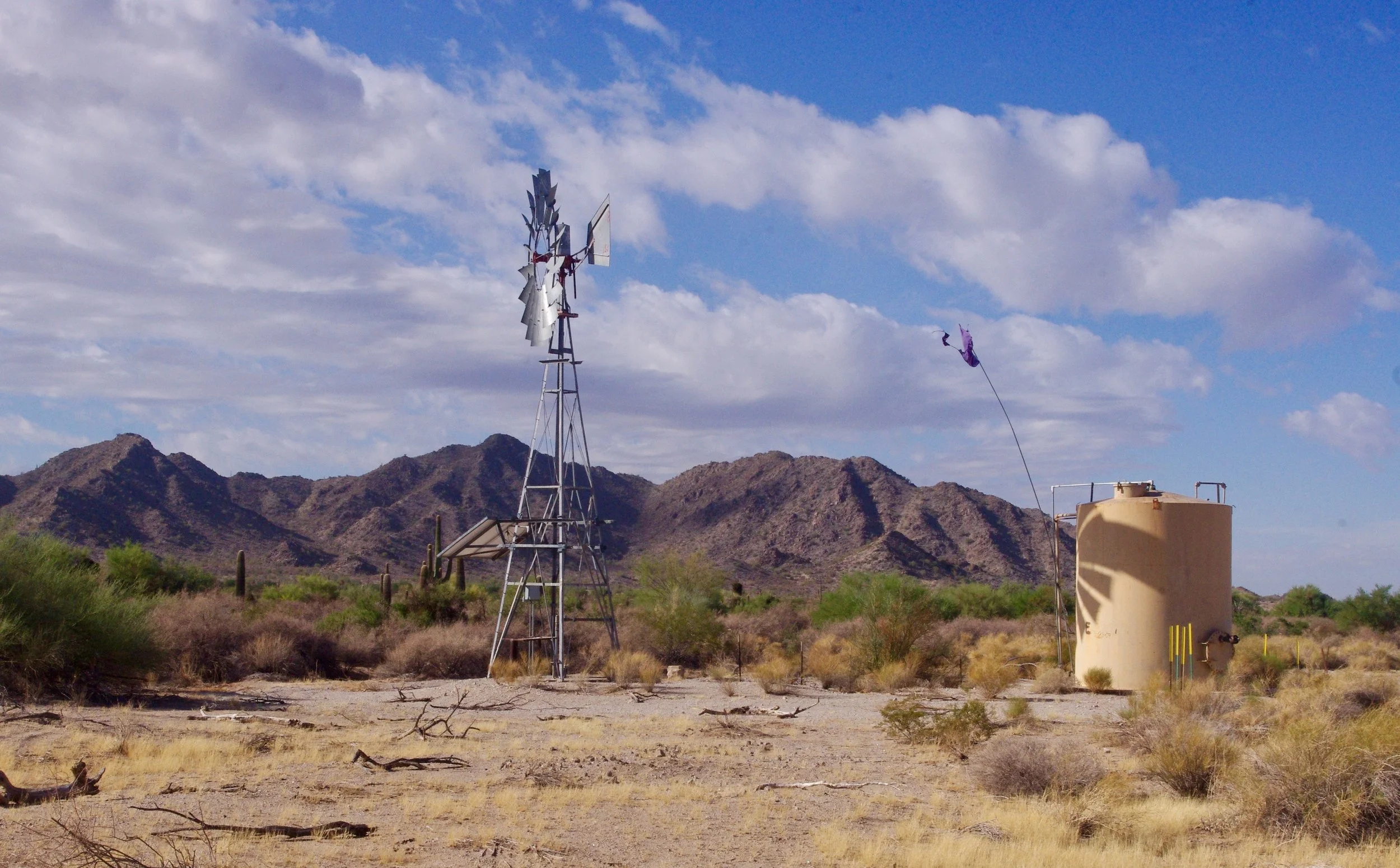
This is Papago Well. On the right side you can see pipes. There’s a spigot, so you can get water here, which is rare in the southern Arizona desert, and so, precious.
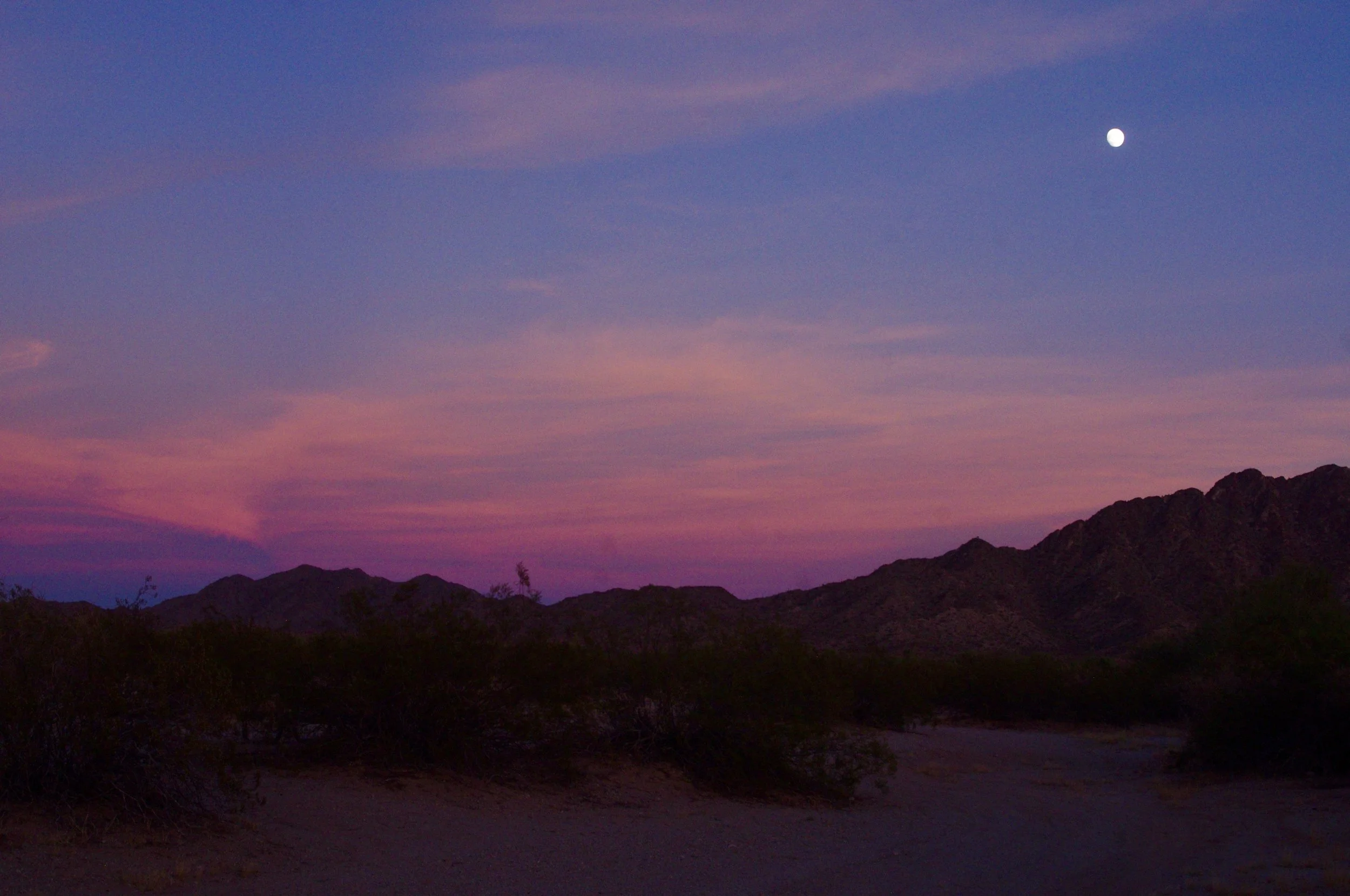
Here’s sunset at the campground (moon included)
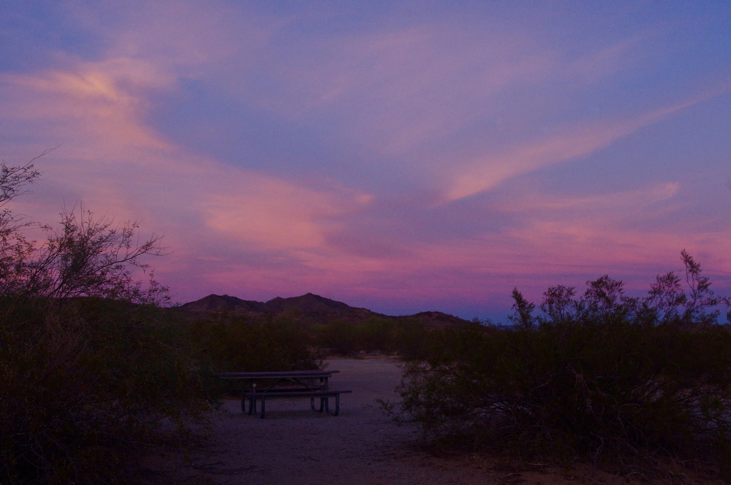
And here is the sunset without the moon. If you squint, you can see one of the picnic tables you aren’t allowed to camp beside. the sky is really better in this photo, but no moon.
Buenos Aires National Wildlife Refuge 10/25/22
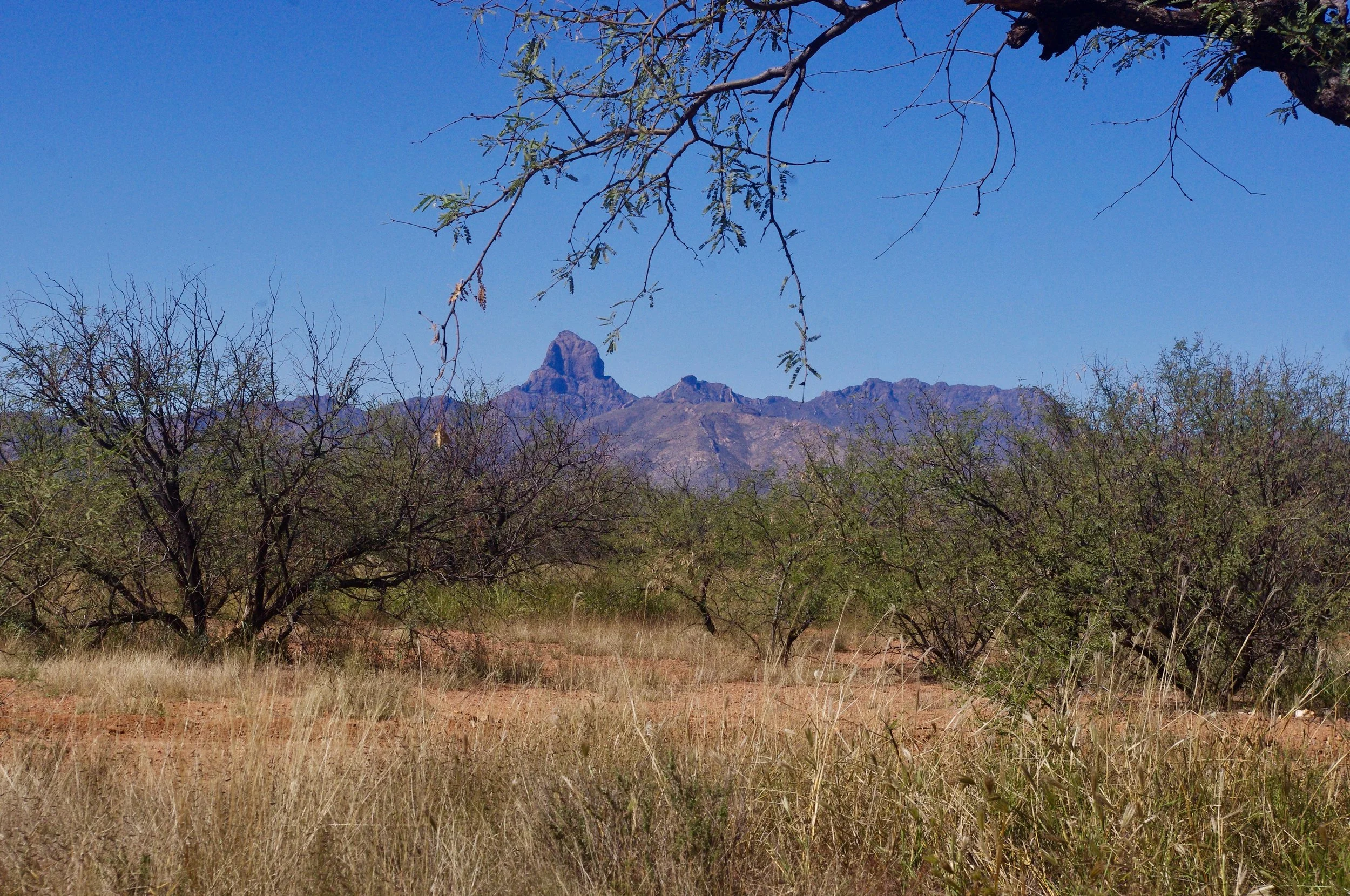
After leaving Rio Grande del Norte, I went south…ever south, fleeing into the sun. I wound up in Buenos Aires National Wildlife Refuge, where you get wonderful views of Baboquivari peak, as you can see below.
Buenos Aires National Wildlife Refuge is busy. I guess I should say it’s set up for busyness as opposed to being actually busy, since I saw zero other campers there. Okay, maybe there was one on the way to the visitor’s center, but they weren’t anywhere close to my campsite. However, there are loads of sites and they are all numbered, so I figure there must be a lot of people there at some point. I camped there a few years before this trip and saw no one then, either, except for a group with rifles motoring around in a 4-wheeler while I was out walking.
If you have a big-rig, the sites at BANWR will accommodate you nicely. However, the first time I drove in, the paved portion of the road (Arivaca road, if I remember correctly) was so terrible that I was limping along at a blistering 5 or 6 mph in the rig I had back then, a 28 foot motor home. I’ve been on many unpaved roads that were better. I thought I’d never reach the camping area. This time around the road was smooth and lovely…ironic, as I was in a 4WD truck with my small, weird, homemade camper perched atop it and could have handled the bad road much more easily.
Mountain views aside, BANWR is basically a lot of flat scrub, as you can see. No towering saguaros, just lots of mesquite and acacia. But it’s late October, and look at the sun! In northern Idaho, you don’t get a lot of sun in late October.
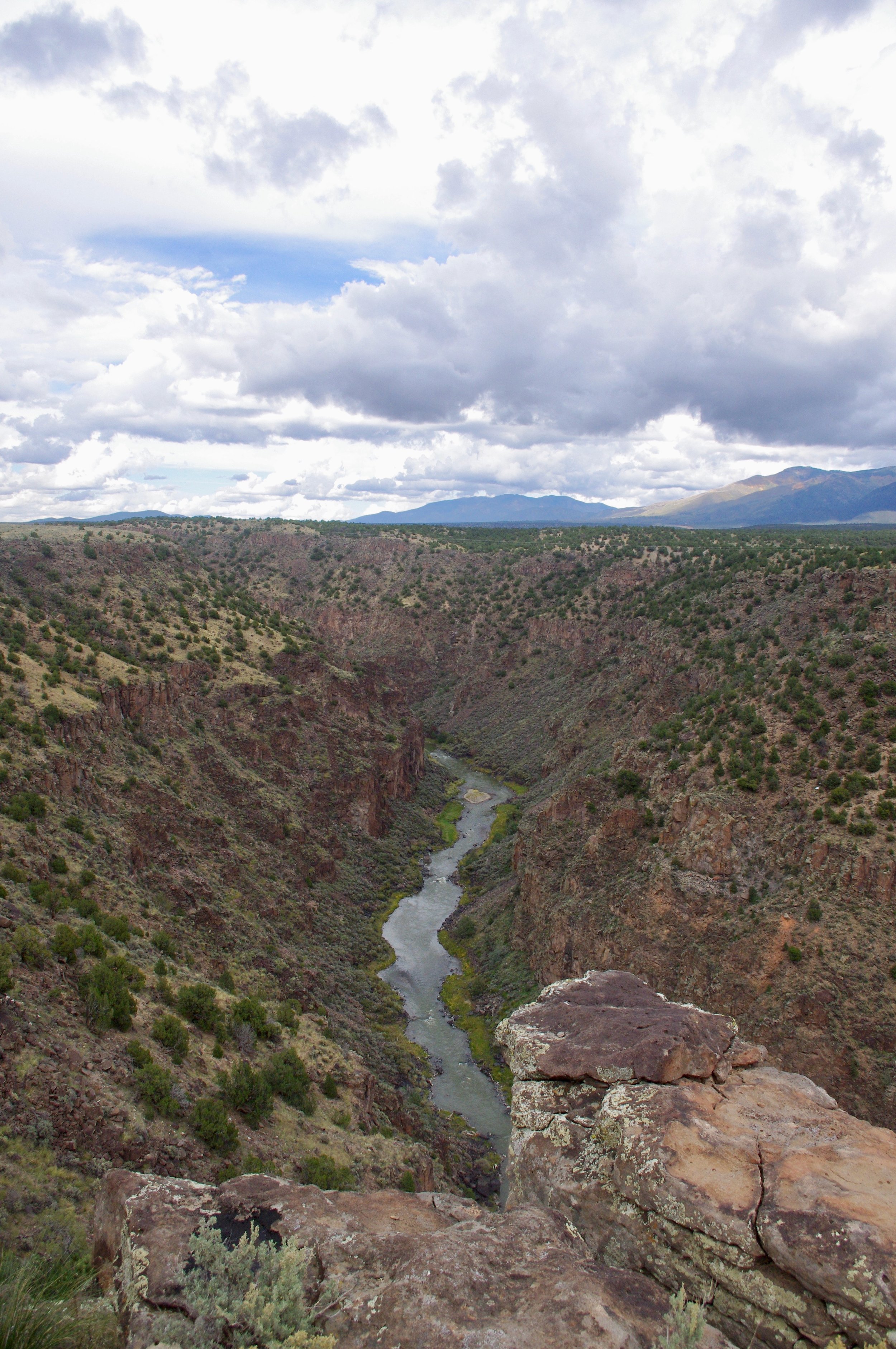
Rio Grande Del Norte 10/22
If you want to camp in Rio Grande Del Norte, this is the place to do it. I only spent one night here and I don’t remember why, but I suspect it was probably due to weather. All I remember is being perched on the edge of this impressive canyon with the river far below…awe inspiring!
I really need to give a shout-out to iOverlander here because I might not have found this site right on the rim of the canyon if not for that app. There are multiple good resources for finding campsites out there, and I’ve used a few different ones over the years, but iOverlander became my go-to app because they show where to get drinking water as well as campsites and other resources (laundry, propane, dump stations, etc.). For a full-time road-warrior, the subscription cost seemed well worth it.

Colorado Rockies 9/22
After leaving Flaming Gorge I headed south, but detoured through the Colorado Rockies just for the sheer joy of it. There are an awful lot of beautiful places in the west, and the Colorado Rockies are right up there with the beautifulest. I didn’t take a lot of photos, but here are a couple showing the Aspens beginning to turn to gold.


Flaming Gorge 9/22
It was only September, so the weather in Wyoming was still nice. This is noteworthy because, in my younger years, I camped in Wyoming in December. Oh my. As I recall, the overnight temperature was somewhere in the region of -5 degrees. Yes, it was below zero. We went to bed sometime around the 4:30 PM mark because we were too cold to stay out of our sleeping bags. I had a cat traveling with me at the time, and the cat spent the night in my sleeping bag near my feet. Sometime shortly after midnight, my son, who was around 11 at the time, got up to use the bathroom and thought he saw the light of dawn. It was a bright moon, but we didn’t know that until we’d already gotten out of bed. So we broke camp and spent the rest of the night in a diner somewhere.
In September, though, Wyoming is a great place to camp, so I checked out Flaming Gorge National Recreation Area. Don’t get me wrong…I loved Flaming Gorge. I just wasn’t completely certain why they named it “Flaming Gorge”. Were there flames? Yes. But they weren’t as prevalent as I expected based on what I’ve seen in other parts of the desert, as you can see in the first photo. Is it gorgeous? I think so. Is it flaming? Mmmm….sort of…..here and there. Maybe they should call it “Flickering Gorge”. Or “Glowing Match-end Gorge”. However flaming it may or may not be, I pulled into a great campsite right on the lake and eagerly walked down to the shore….only to sink into the soft bank up to my mid-thigh. So I couldn’t do much lake-walking even though the lake was temptingly close.
A group of prong-horn antelope wandered through my campsite one day, and that was exciting. I’ve had trouble photographing prong-horn antelope over the years. They’re quick, they don’t like to pose, and they don’t like photographers (or maybe it’s just me they don’t like). In this case though, I was able to snap a quick pic before they got disgusted and bounded off.

This is a view of “Flaming” Gorge on the way to the lake

This is where I camped. Doesn’t that lovely water just invite you to take your shoes off and walk around by the water? Don’t even attempt it! You might sink all the way up to your neck in soft gravely-mud-like material.

Here are the Prong-horn. You can even see the horns on one…yay!
Beautiful Wyoming
So Wyoming is basically a large, cold desert. I think most of it is technically ‘semi-arid’ rather than ‘desert’, but it LOOKS like a desert. Which is why I like it. There are some riparian areas such as this place I camped along the Green River. This is the view from my campsite on one of the rare occasions when there was nobody fishing there. This must be a fabulous fishing area because there are about a zillion people here fishing every day. At night, they run generators so the fish don’t get lonely (or complacent). Even so. You have to love a back yard like this.
City of Rocks
After a wonderful stay at Craters of the Moon, I detoured south to City of Rocks. ‘Detouring’ is the only way to get to City of Rocks. It is not just out of the way from Craters of the Moon, it is out of every way from everywhere. Still, there were so many hordes of people there that I had to spend two nights in an already-reserved campsite because every one of the 65 campsites in the park had a ‘reserved’ sticker on it. I know. I looked at all of them. I found one that was ‘reserved’ for 9/16 and stayed in it on 9/13-9/14. City of Rocks is a rock-climber’s paradise. Since I can barely walk across a level parking lot without falling over, I don’t do a lot of rock-climbing. My version of rock-climbing is climbing back onto my feet after doing a face-plant into a pile of rocks because I tried to walk over them and lost my balance. However, the massive piles of granite that rock-climbers enjoy scaling are very scenic, as you can see below.
Here’s me camping at CoR. This is my new swing-away trike rack, which is pretty slick, thank you North Idaho Welding and Supply.
There were some rock-climbers on this ‘boulder’ later in the day. It is so big the climbers were almost invisible.
This gives you an idea of the scale of these rocks. That little building is a vault toilet near some campsites among the rocks.
The rocks are everywhere. It’s almost like…an actual CITY made entirely of ROCKS. Go figure.
Craters of the Moon
After a brief stopover in Boise, (not brief enough…no stopover in Boise can be brief enough even if it is 15 minutes at a gas station) I proceeded east to Craters of the Moon National Monument. Craters of the Moon is covered with blasted trees and bizarre lava formations, two of my favorite things in the whole world. The campground was horribly crowded, but that’s because lots of other people also enjoy blasted trees and weird lava formations. There are some lava tube caves at CotM that I hiked into a few (or a number of) years ago, but apparently they now require a special permit that I didn’t bother to obtain. I was perfectly content to ride around the scenic loop on my trike and admire the blasted trees and weird lava formations.
Trail to North Crater
One of many blasted trees
Giant heap o’ lava
More giant heaps o’ lava
Hart Mountain Antelope Refuge
After a wretched 2 or 3 months in Bonners Ferry getting my trike repaired (after running over it when my trike rack failed) and a new trike rack built (hopefully too high off the ground to bottom out and fail again), we are off and rolling at last. First stop, Hart Mountain Antelope Refuge. The goal was to arrive before the hunters did shortly after Labor Day, and that goal was achieved. That is the benefit of setting modest goals…one is able to congratulate oneself on scoring a constant series of microscopic victories.
Hart Mountain is in southern Oregon east of the Cascades, so it is high desert…I’ve yet to meet a desert I didn’t like. It also has a small collection of hot springs into which I enthusiastically plunged, ignoring the algae and bits of muck that settled on the bottom of the pools and came up in waves when disturbed by human feet. There was a lovely pool that appeared to be missing both the algae and the muck, but it was barely warm, so I gave that a pass. In fact, I chose the worst-looking pool (1/3 to 1/2 covered with algae flotillas) under the assumption that it would be used by fewer other people, and, indeed, I had it all to myself. That was a good thing, since it’s really only big enough for one person.
I also inaugurated the rebuilt trike, with good results. Drive train working properly for the first time in, oh, 18 months or so. Unfortunately, the propulsion system (legs) seems to have suffered from months and months of inactivity, so the rides were short.
Here is the beautiful, clear, deep pool at the hot springs. Unfortunately, it’s also not very hot.
Here is the nicest of the two natural pools. No algae flotillas here. It is also the hottest pool, and the one preferred by most people other than myself.
This is what the refuge in general looks like. Here is my trike at Lookout Point
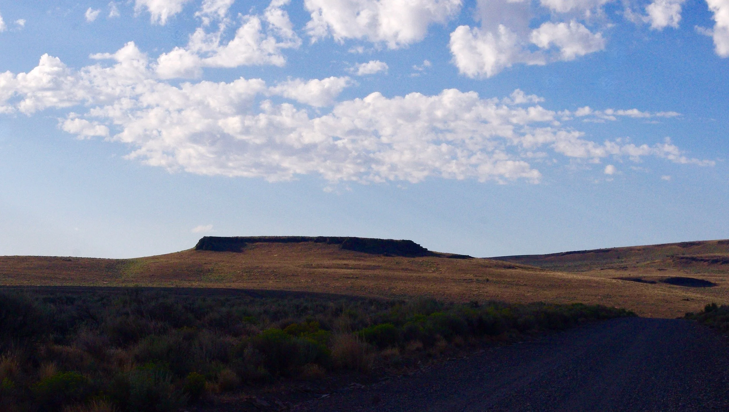
Butte on Blue Sky Road
Big Sur
After viewing the otters, we drove past San Simeon (one of the world’s most tasteless mansions — it’s well worth seeing just so you know that money can’t necessarily fix ugly) and up to the southernmost end of Big Sur. I haven’t been to Big Sur in 45 years or so. It is really beyond compare. It’s a shame I messed up my camera settings, but there are some landscapes that are so beautiful they cannot be ruined by poor photography, and Big Sur is one of them.
looking south toward Harmony Point/San Luis Obispo
Otters -- or should I say "otter silhouettes"?
From KofA, I made a mad dash over to the California coast to visit my sister. The California coast is gorgeous. I’m sure this fact will surprise no one. North of Morro Bay, there is another bay whose name I forget, (possibly Escondido?) and near one of the jetties jutting out into the bay there is a colony of otters. Naturally I had to go see the otters. It was great seeing the otters. The weather was perfect, and the area is lovely. There were dozens of otters lolling about amidst the rocks and seaweed, turning summersaults and doing barrel rolls. Unfortunately, due to a number of factors, all 200+ of the photos I took were total crap.
1) My camera was still set on ISO 6400, so all the pictures are horribly grainy
2) My best zoom lens is only 200 mm. This magnification was inadequate to shoot the otters.
3) And, probably most importantly, the light was behind the otters, so they weren’t lit up. I could only see otter silhouettes, flapping legs and tails, heads bobbing around, etc.
Of these (the flapping, rolling, heaving silhouettes) I saw many. And just to prove that there were, in fact, otters and I did, in fact. see them, I selected these from my 200+ photos…they all looked pretty much like this.
The otters like to float with their heads and feet sticking out of the water, and that’s basically what you see of them: heads and feet bobbing around in the water. There’s a lot of splashing and flailing legs as they roll around.
This one was doing summersaults.
KofA - Crystal Hill
When we had overstayed our welcome near Yuma, we went back to KofA, this time at Crystal Hill, where there’s a camping area along a wash with actual trees that cast actual shade. Shade is helpful when the temperature is pushing 100 degrees.
On the way to KofA, I wrecked my trike, so it is now totally unrideable. That makes sightseeing a bit tough for someone who can barely totter 2 or 3 miles even when decked out in major gear such as leg braces, knee-braces, heavy boots and hiking poles. However, I was determined to walk up to a saddle in the mountains to the south of my campsite, so I undertook a four-hour hike, barely reaching my goal. It would have taken a normal person a couple of hours. From the saddle, one could see….more desert. It’s a great spot if you like the desert.
If you zoom in, you can see the Ocotillo are in bloom…there’s one in the center of the picture.
It must have been right after I took the above photo that, in manhandling my camera around as usual, I managed to lock the ISO setting on 6400 (again). So all my photos became horribly grainy. The picture below (looking back across the valley toward where I am camped) is so grainy that it almost looks like an Impressionist painting.
That dark hill in front of the lighter hills in the distance is Crystal Hill. I am camped at the foot of that hill. I have no clue how many miles away it is, but I estimate somewhere around 3. Yes, it takes me 2 hours to walk 3 miles. That is how speedy I am.
Bees in the desert
It turns out that there are bees in the desert (honey bees, I mean). It also turns out that they are constantly on the lookout for water. So I stood on my little scrap of indoor-outdoor carpet to take a shower one day, and a few minute later, the carpet was ‘claimed’ by about a zillion bees. The bees were so persistent in their pursuit of water that I started doing my moisture-producing chores (such as washing dishes) several yards from my door because the bees kept flying into my rig. I don’t like bees in my rig. I like honey bees (as opposed to wasps and hornets), but not in the house. They land in various places where I don’t notice them, and then I put my hand or foot on one and it stings me. I did get stung once, but honey bee stings aren’t terribly painful so it was no big deal. Harvester ant stings are much worse. They are similar to wasp stings and hurt for hours. I discovered that I could deal with them by removing cold apples from my refrigerator and applying them to the sting for 3 or 4 hours until they stopped hurting.
Cibola Lake
Several miles south of our campsite in the Cibola wildlife refuge (according to the map) is Cibola Lake proper. It’s an odd place. I rode my trike down a road which, according to the map, runs right along the lake for miles (3? 5 maybe?) and saw…pretty much nothing. There was water all right: the Colorado River (which at that spot looks about as wild and river-like as the All American Canal). But where was the lake?
At the end of the road, I found an 'overlook’ of the lake, and the first photo below is the view from that overlook. Sluggish channels through the reeds. I guess that’s the lake. On the way out, I stopped at two parking areas labelled ‘Cibola Lake’ and realized that they were access points to the sluggish channels through the reeds for intrepid boaters desiring to fish the “lake”. They were both closed.
Now, if we left the overlook and looked south, we saw something that actually resembles a lake, but I could not find any road in, even a bad one. So boaters are confined to the marshy area.
At the end of the road, there was this cable car across the Colorado. I spent probably 20 minutes trying to figure out how it might work with only limited success. Most notably, I wondered what fail-safe mechanism there might be in case someone (just as an example) put their trike on the cable car and tried to cross the river on it, reached the middle of the river and discovered the teeny motor I heard running but could not find was incapable of pulling the car/rider/trike to the other side. As you can see, there’s a substantial dip in the middle of the cable, so getting back to shore is an uphill climb. Like, wasn’t there a rope one could pull on to manually haul oneself to one side or the other in case of emergency? Apparently not. I was unable to find any such thing. So I didn’t try riding the car (tempting as it was).
Here is the view from the Cibola Lake overlook. Hm. This area of semi-watery material is where the boating access points to Cibola Lake are.
So here’s something that looks lake-like. But it is nowhere near the ‘Cibloa Lake Overlook’…in fact, it is in the opposite direction. And the ‘Cibola Lake’ access parking lots are nowhere near this body of water either. It’s all very confusing.
Here is the freeway bridge across the Colorado near Cibola Lake.
Cibola Wildlife Refuge
When we had stayed out the permitted two weeks in KoFA, we decided to explore Cibola Road, which traverses 45 miles between US 95 and Cibola Lake on the Colorado River. Most of the road is good, but there are several areas I wouldn’t drive an RV over, and they are at the far end, so no turning around unless you want to drive 35 or 40 miles back out. According to the map, this 45 mile dirt road is the only way into the lake…not true. It took us close to 2 hours to drive the road, and we arrived only to discover pavement, giant snowbird RVs, and the wildlife refuge headquarters. So basically we spent 2 hours driving a crap road when we could have come cruising in on the pavement.
Anyway, I’ve camped Cibola before and didn’t like it. This time was way different. Before, I was stuck in an abysmal spot called “Hippie Hole”. It was the first year of CoVID, March or April, I forget which because I have blocked it out. I suppose it didn’t help that it was 100 degrees and the place was jammed. It was only a few feet from the river, but you couldn’t access the river because the bank is impassible in most spots, and in the couple of spots where it was not impassible, people had set up elaborate camps and claimed the entire riverfront. I think I stayed for two nights and fled in disgust.
This year we camped in the desert a bit south of headquarters, on the Arizona side (Hippie Hole is, I believe, on the California side). We were only 3 miles from headquarters, so I rode my trike around the “auto tour loop”. The weather was fabulous, the skyscapes incredible and there was a great little riparian area with a nature trail. I saw hordes of Snow Geese, many ducks, and some Sandhill Cranes that were grazing in a corn field.
Snow geese on the Auto Tour Loop
Sandhill cranes
Cibola sky
KofA Wildlife Refuge
KoFA wildlife refuge is a spot I return to every year. This year though, I bypassed the Crystal Hills area where I usually go and continued south to King Valley. The road into King Valley is quite good, better than Crystal Hills, but it’s 15 miles or so south, so further from Quartzsite (which is a good thing) and there’s no cell service, not even the crappy service you get out of Quartzsite at Crystal Hills. The only downside to King Valley is that it’s all wilderness so you can’t camp more than 100 feet from the road. I found this out the hard way by getting busted for being 400 feet off the road. The person who busted me was totally unimpressed by my explanation of how I came to camp in a non-sanctioned area and promptly erected a new “do not drive here” sign to keep me in line on future trips.
I rode about 8 miles down the road from our campsite but didn’t make it to the mine site (KofA stands for “King of Arizona”, an old mine). Maybe another year. Instead, I contented myself with gazing at the whimsical shapes of the mountains visible from our campsite.
Moonrise in King Valley
King Valley mountains near sundown
Mojave Preserve
I camped in the Mojave Preserve last year about 100 feet from the road. People came streaming into my campsite all week, and one person actually plopped his rear a few feet from my door and stayed there all night and half the next day in an Involuntary Campsite Sharing Incident. I was not eager to repeat that experience, plus now I have a back-country-capable vehicle, so we drove into the mountains to camp among the Joshua trees. The road in (Ivanpah) wasn’t bad. Driving out over New York Mountain Road was quite the experience, though. Definitely wouldn’t recommend that for a regular car. A lot of it was quite passable, but there were some gnarly spots that would have been quite hair-raising (were quite hair-raising even in a truck), and once I actually had to shift into 4WD to get un-stuck out of deep gravel. Not to mention bashing my trike rack against the ground several times due to severe unevenness in the road.
The Mojave Preserve is great…I plan to return there on a regular basis. It’s not all that photogenic, but here’s a snapshot of the terrain around our campsite just to give you the flavor of it.